Your Complete Guide to the smoky mountains
DESTINATION GUIDE · TENNESSEE & NORTH CAROLINA
Everything you need to know before your first (or fifth) visit
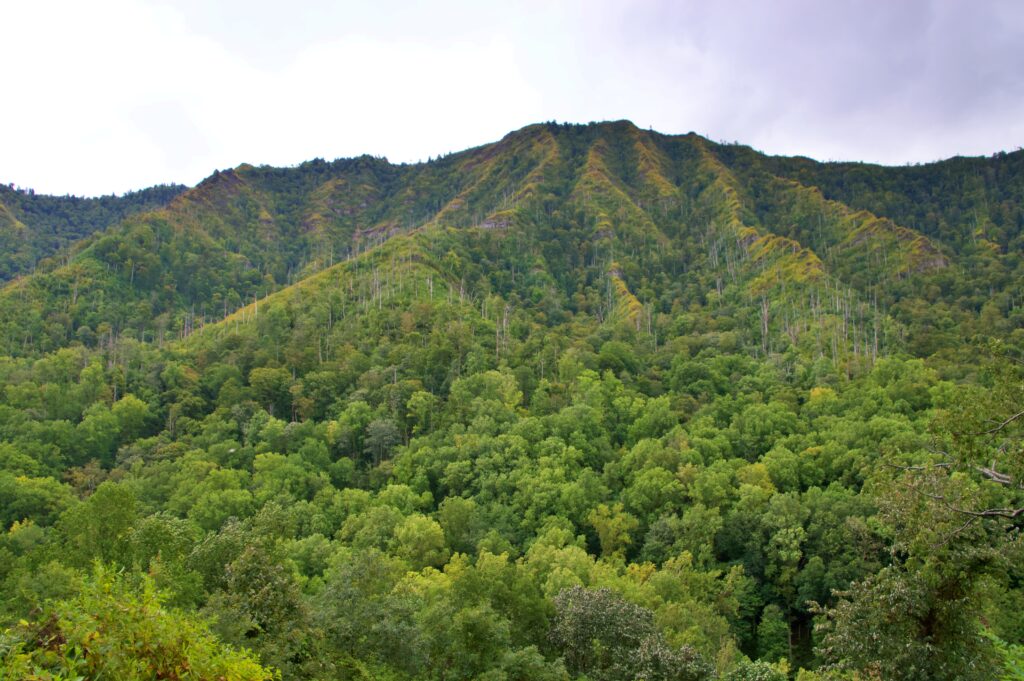
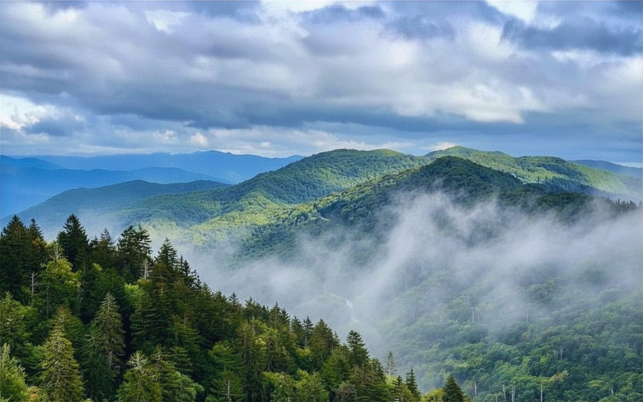
The first time you drive into the Smokies, the scale of it catches you off guard. We visited just after Labor Day, when the evenings had turned cool but the days still held onto summer’s warmth, and the leaves were only just starting to turn — that first hint of color scattered through miles of green. We spent most of our trip simply driving: the park is enormous, and half the experience is just covering ground and letting the landscape change around you.
This guide is the practical side of that trip — where to stay, when to go, the hikes worth the effort, and a few things we learned firsthand, including one view that eluded us no matter how many times we tried.
Getting There & Getting Around
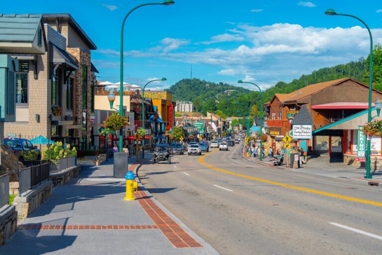
The two main gateway towns are Gatlinburg and Cherokee, sitting on opposite sides of the park. Gatlinburg is the lively, touristy hub on the Tennessee side — think pancake houses, fudge shops, and an aerial tramway. Cherokee is the quieter, culturally rich North Carolina entrance, home to the Eastern Band of Cherokee Indians and a wonderful casino resort if that’s your thing.
The closest major airports are McGhee Tyson in Knoxville (about 45 minutes from Gatlinburg) and Asheville Regional in North Carolina. Either works well depending on which side of the park you want to explore first. You’ll absolutely want a car — public transportation inside the park is limited, and half the joy is being able to pull over whenever a scenic overlook catches your eye.
One of the best things about the Smokies? The park is free to enter and open 365 days a year — one of the few national parks in the country that doesn’t charge an admission fee. If you plan to park longer than 15 minutes, you will need to buy a parking tag available online from Recreation.gov.
When to Visit
Every season in the Smokies has its own personality, and there’s no wrong time to go. Here’s what to expect throughout the year, including what we saw firsthand during our own fall visit.
Spring (March–May) brings wildflower blooms that are truly breathtaking. The park hosts a Wildflower Pilgrimage each April that draws nature lovers from across the country, and waterfalls are at their fullest after winter snowmelt.
Summer (June–August) is peak season and the park gets crowded, especially on weekends. Early mornings are your best friend — hit the trails by 7am and you’ll feel like you have the place to yourself.
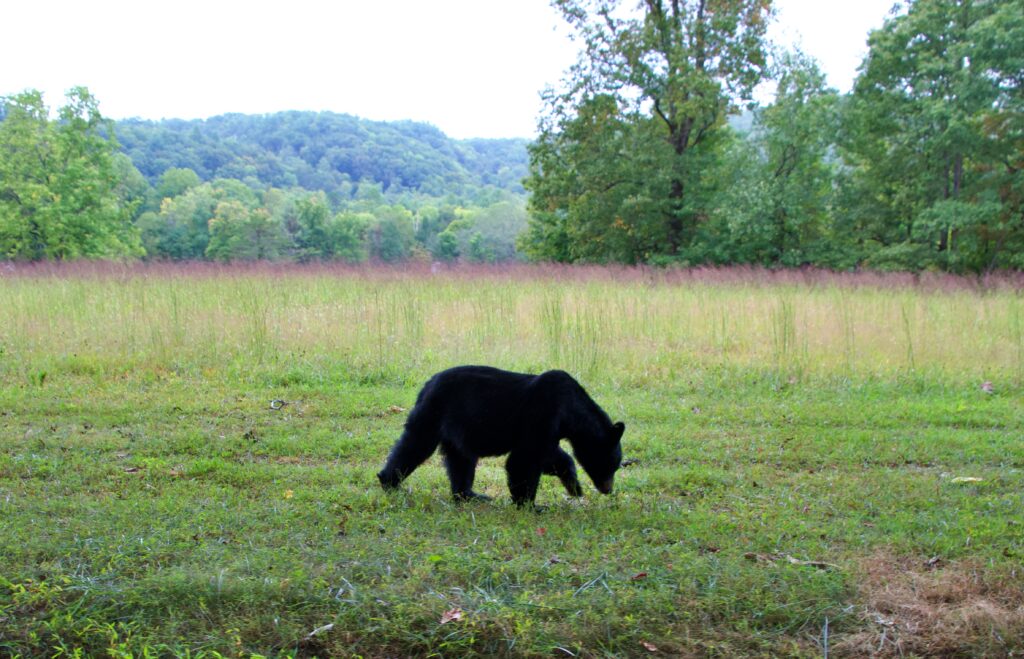
Fall (September–November) is when we visited, arriving just after Labor Day. The leaves were only beginning to turn, but the cooler evenings and warm days made for some of the most comfortable hiking and driving weather we could ask for. Fall is also feeding season for black bears — they’re working to put on weight before winter, which means sightings are far more common. We saw more bears in a few days than we expected to see in a lifetime. Mid-October brings peak color for those chasing the full foliage show, so book accommodations well in advance if that’s your target.
Winter (December–February) is the Smokies’ best-kept secret. Crowds thin out dramatically, lower-elevation trails are often clear, and catching a light dusting of snow on the mountain ridges is something you won’t forget.
The Hikes You Won’t Want to Skip
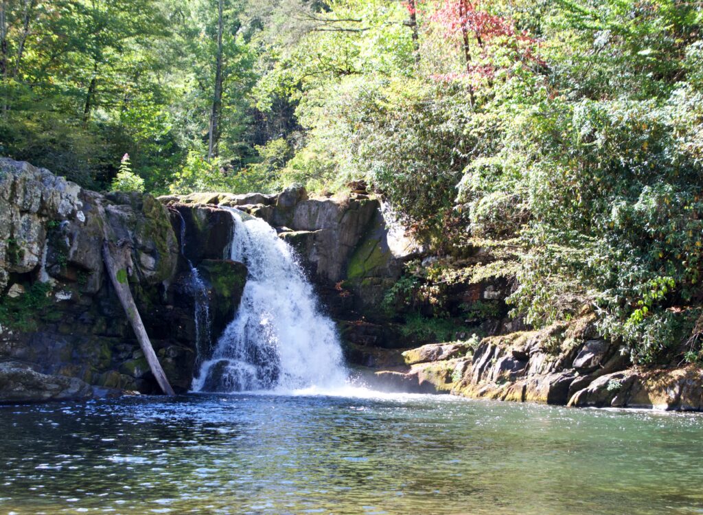
With over 800 miles of trails, the Smokies can feel overwhelming to plan around. We hiked to Abrams Falls, a rewarding trek through the woods to a wide, powerful waterfall — one of the best payoffs for moderate effort anywhere in the park, and the highlight of our hiking on this trip.
We didn’t have time for some of the more demanding trails below, but they’re popular enough, and beautiful enough, that they’re worth knowing about — and they’re on our list for next time.
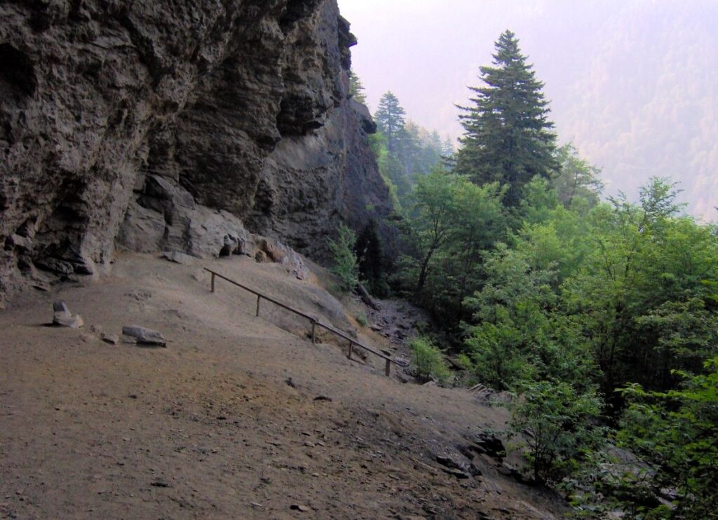
Alum Cave Trail is one of the park’s most beloved hikes — it passes through old-growth forest, along a stunning ridgeline, and past dramatic rock formations before reaching the cave bluffs. The full round trip to Mt. LeConte is 11 miles, but even the 4.4-mile out-and-back to the bluffs is incredibly rewarding.
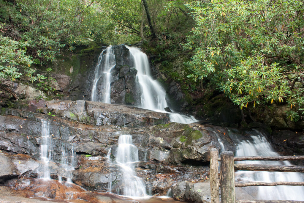
Laurel Falls Trail is the go-to for families or anyone who wants a gorgeous payoff without a grueling climb. It’s a 2.6-mile paved round trip to the most visited waterfall in the park — and yes, it earns that title.
Chimney Tops Trail is closed at the summit following the 2016 wildfires, but the lower portion has reopened and remains one of the steepest, most exhilarating climbs in the park. The views from the lower overlook are spectacular.
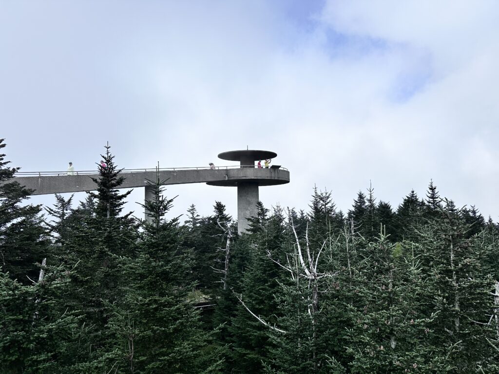
Kuwohi (formerly Clingmans Dome) & the Appalachian Trail — the observation tower sits at 6,643 feet and on clear days, visibility stretches up to 100 miles. It’s also an easy way to walk a stretch of the iconic AT.
We drove up three separate times during our visit. Each time, the valley below was clear and sunny — and each time, the summit itself was completely fogged in. No view, not once. It became a running joke by the third attempt. If you’re chasing that famous 100-mile visibility, know that it’s not guaranteed even with persistence; check conditions before you make the drive.
Scenic Drives
Cades Cove became our home base. We camped there and spent most mornings and afternoons simply driving the loop road, watching the valley change with the light. It’s slow going by design — the road doesn’t rush you, and neither should you. This is also where we saw the bulk of our bears; in September, they’re moving through the open fields and forest edges constantly, foraging ahead of winter. If you only have time for one part of the park to really settle into, this is the one we’d point you toward.
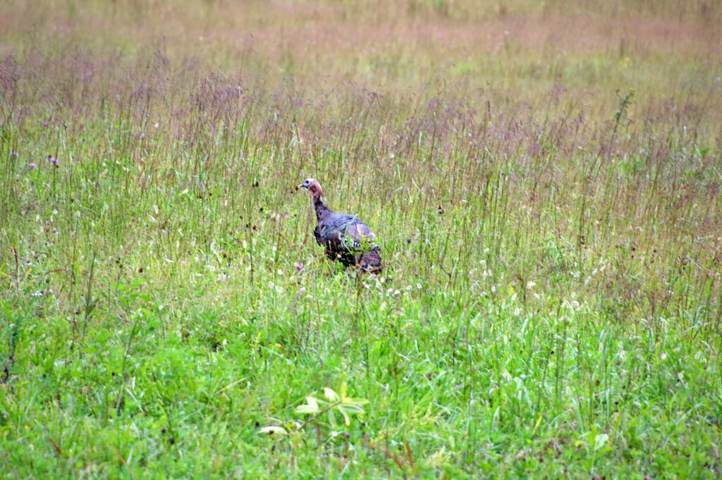
Cades Cove after hours — most visitors drive the loop road during the day and leave before sunset. If you’re camping in the Cove, make a point of being out on the loop road at dusk. The open fields come alive with deer, wild turkey, and occasionally black bears moving through the meadows in the fading light. It’s a completely different experience from the daytime traffic.
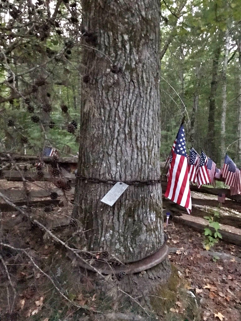
The Pearl Harbor Tree is one of the most quietly moving places in the entire park — and almost no one knows it exists. Tucked on a forested hillside in Cades Cove, a sweet gum tree was planted by a local farmer on December 7, 1941, the morning he heard the news of Pearl Harbor on his radio. More than eighty years later, visitors still climb that hillside and tuck American flags into the old tire rim at the tree’s base. It’s not marked, not sign-posted, and not on any Top 10 list. You have to want to find it.
Roaring Fork Motor Nature Trail
Just outside Gatlinburg, the Roaring Fork Motor Nature Trail is one of the park’s most overlooked drives — a 5.5 mile narrow, one-way road that winds through old-growth forest past historic homesteads, cascading streams, and some of the park’s most atmospheric scenery.
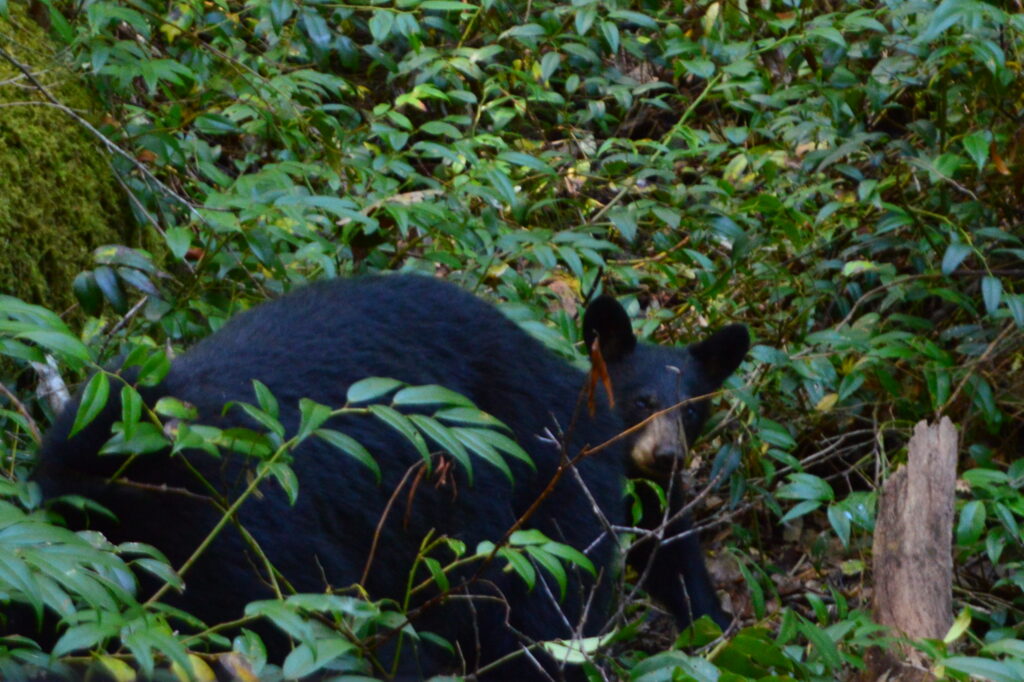
This drive gave us one of the trip’s best moments. A mama bear with three cubs emerged suddenly from the brush right along the road. She caught us off guard and we didn’t get the camera up in time to catch all of them, but we managed to capture one of the cubs. It was one of the highlights of our trip.
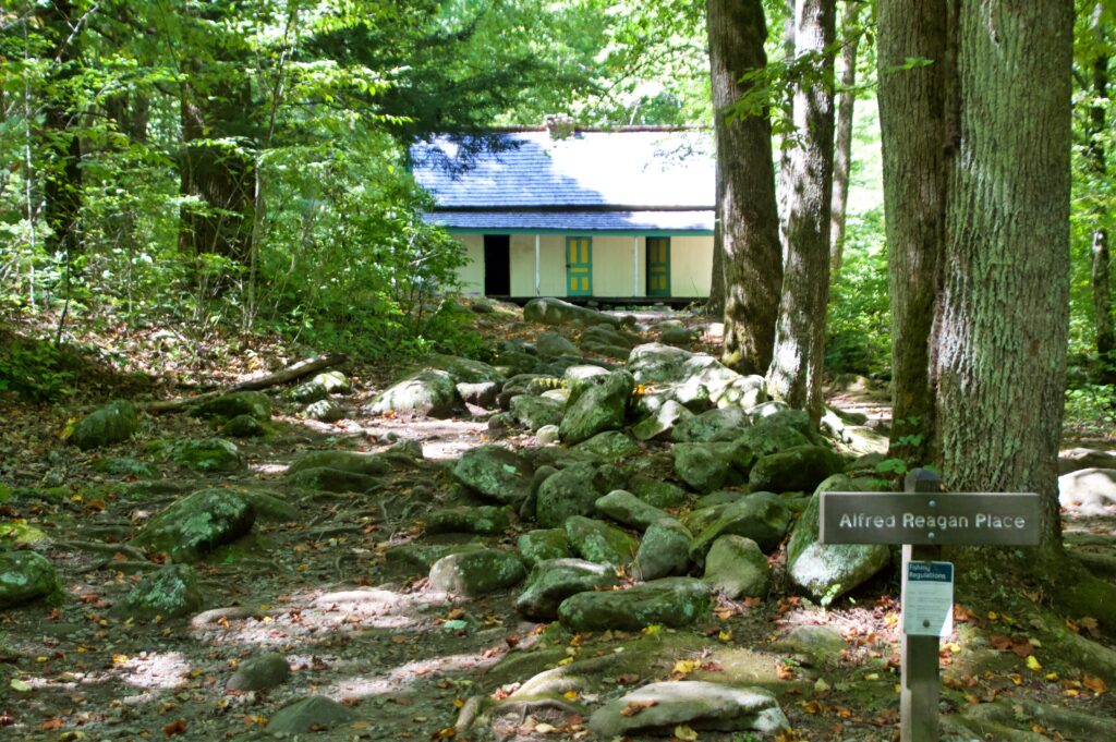
The trail is also home to some of the best-preserved homesteads in the park. The Alfred Reagan Place is the only historic home along Roaring Fork that’s been painted, and it’s easy to see why it stands out.
Reagan built it in a “saddlebag” style, two cabins joined around a single central chimney. Reagan himself was a true jack-of-all-trades: master carpenter, blacksmith, storekeeper, and part-time preacher for the community.
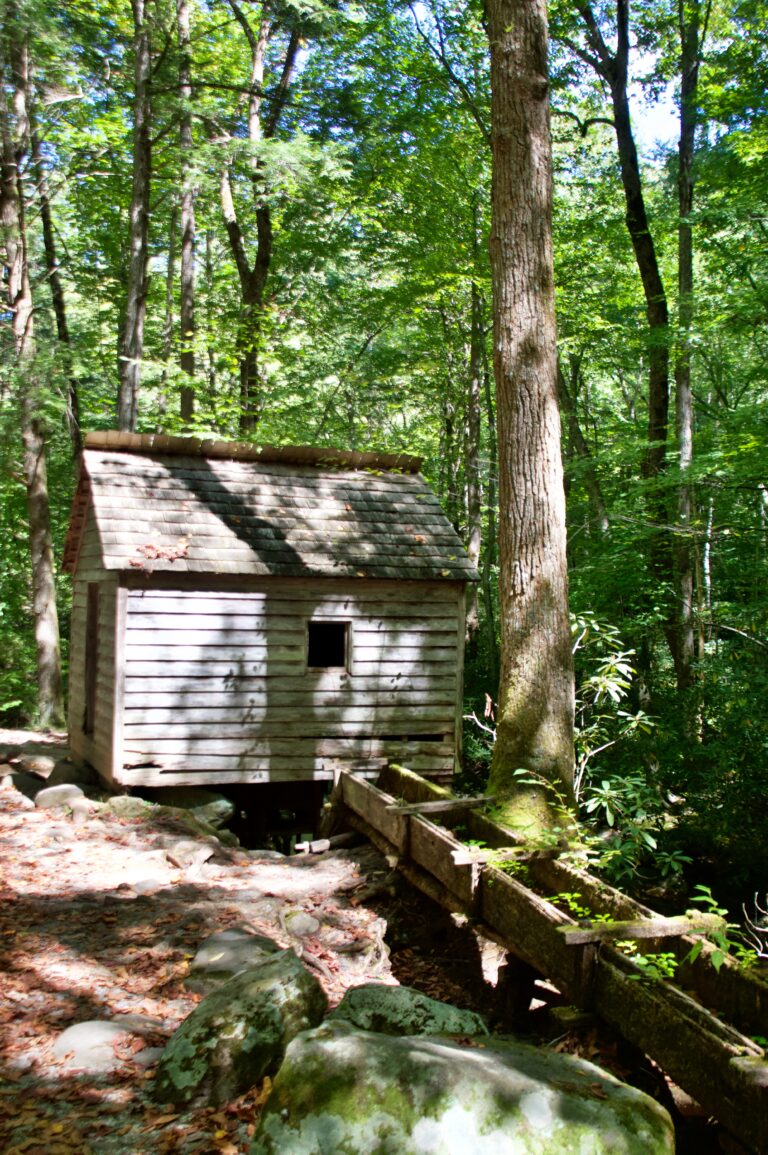
Just down the path, his water-powered tub mill, built around 1895, used a compact turbine wheel tucked under the floor a design so efficient it could keep grinding corn even when other local mills were forced to shut down for low water. Reagan charged a toll of one gallon of corn for every bushel he ground.
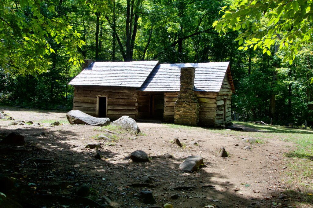
Nearby, the Ephraim Bales Place is one of the more unusual homesteads on the trail a “dog-trot” style cabin made of two separate log structures placed side by side and connected by a single common roof and open walkway.
Ephraim and his wife, Minerva (“Nervy”), raised nine children here, from around 1890 until the property became part of the national park in 1930. Alongside the house, you can still see a moss-roofed hog pen, a small barn, a corn crib, and a stream running behind the cabin.
It’s an easy add-on to a day spent in town, and a nice contrast to the shops and crowds just a few minutes away. Allow at least 90 minutes and plan to stop often. The motor trail closes seasonally from early December through late March to ensure visitor safety from icy conditions.
Newfound Gap & the Rockefeller Memorial
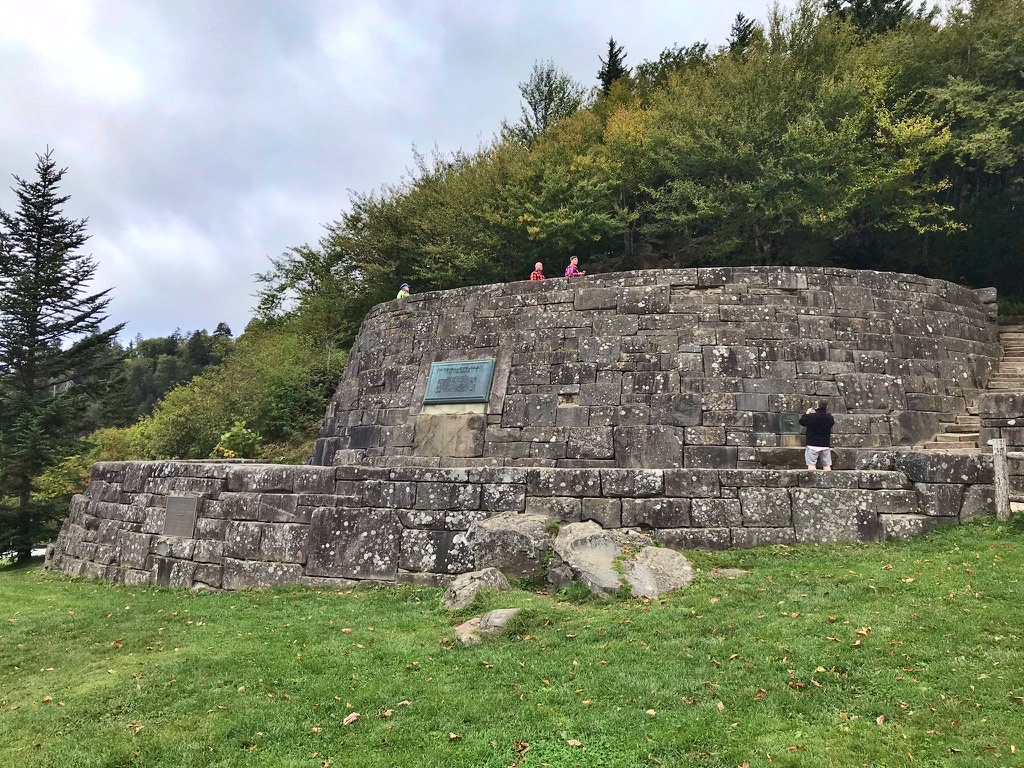
Right at the state line between Tennessee and North Carolina, at an elevation of just over 5,000 feet, sits Newfound Gap — a natural stopping point along Newfound Gap Road, and the turnoff for Kuwohi.
It’s also home to the Rockefeller Memorial, a two-tiered stone structure built directly on the state line. This is the spot where President Franklin D. Roosevelt formally dedicated Great Smoky Mountains National Park on September 2, 1940, with a plaque commemorating the $5 million gift from John D. Rockefeller, given in memory of his wife, Laura Spelman Rockefeller, that helped fund the purchase of the park’s land.
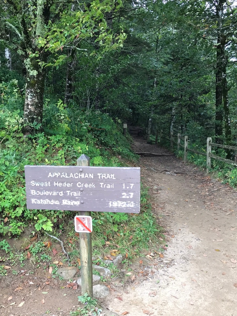
The Appalachian Trail also crosses right through Newfound Gap, so this is an easy place to actually set foot on the AT without committing to a full hike — walk a short stretch of it, or just snap a photo at the trailhead sign.
There’s an interpretive marker right there that puts the trail in perspective: at over 2,150 miles running through 14 states, the AT is one of the longest continuous footpaths anywhere, and the stretch through the Smokies is considered one of its more remote, demanding sections, following some of the highest ridgelines in the Appalachians and tracing the Tennessee–North Carolina border for 70 miles.
It’s easy to forget, standing at a well-marked trailhead with a parking lot nearby, that most of that ribbon of trail was carved out by hand — Civilian Conservation Corps crews in the 1930s cutting rock and felling trees to build the path that now stretches from Georgia all the way to Maine. It’s a quick stop, but a meaningful one, and it fits neatly into a day that’s already headed toward Kuwohi or over to the Cherokee side.
Oconaluftee & Cherokee
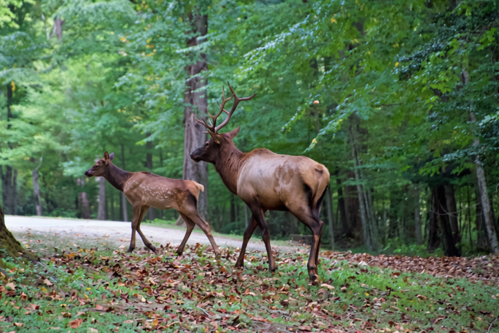
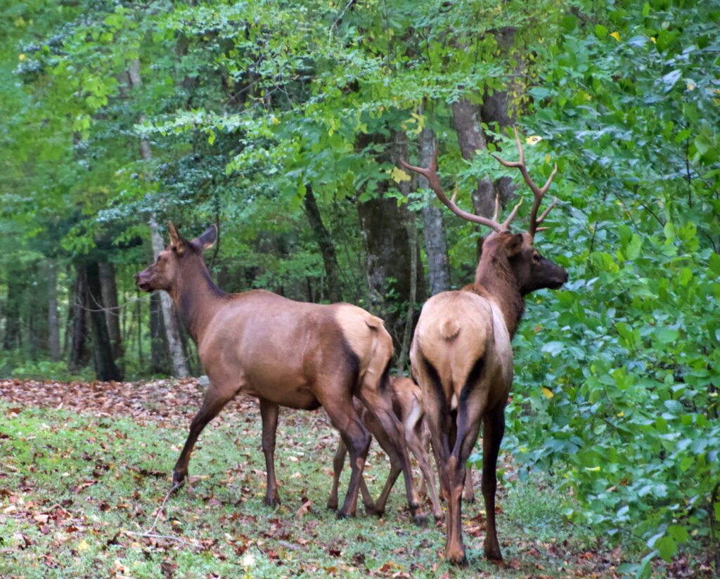
On the North Carolina side, near the Oconaluftee Visitor Center, we came across groups of elk grazing by the side of the road — a great, easy wildlife sighting without needing to hike anywhere.
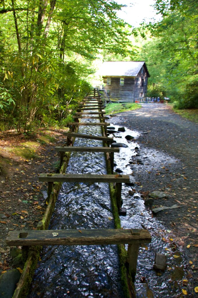
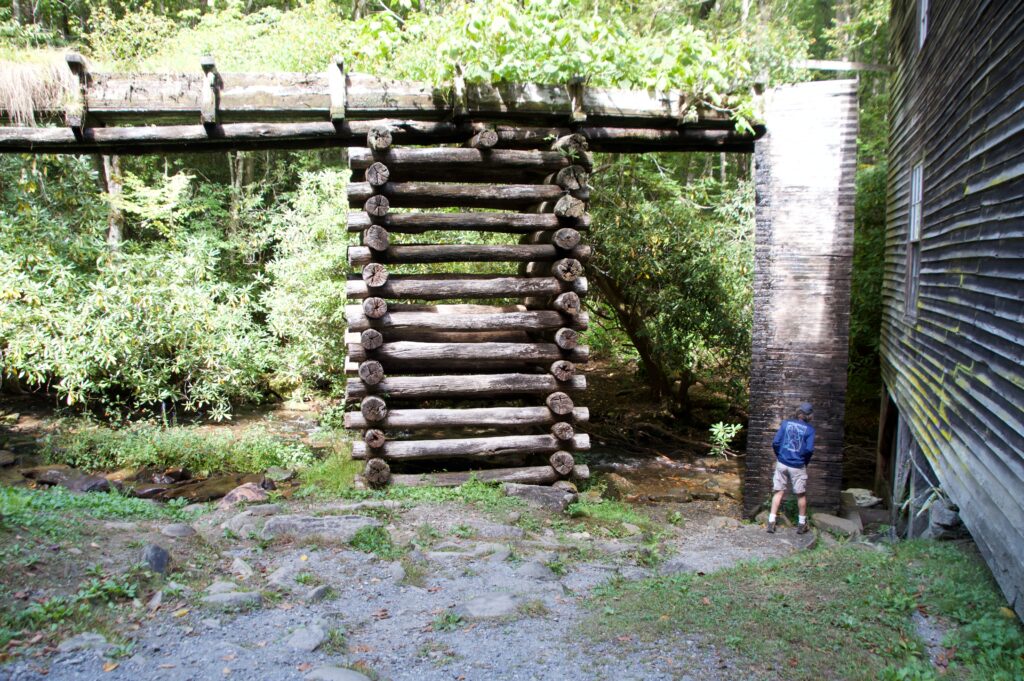
Nearby, Mingus Mill is worth the short stop. Built in 1886, it ground corn and wheat for the Mingus Creek community for 50 years, and it’s still in working order today.
Rather than a traditional water wheel, the mill uses a water-powered cast iron turbine to turn its stones — water builds up pressure in the wooden penstock, and the miller historically charged a toll of one-eighth of the grain he ground in exchange for the work.
The town of Cherokee itself surprised us. It’s a genuinely quaint town, and we ended up spending a fun, easy afternoon wandering it on foot — mostly because of the painted bears.
The Great Bear Hunt
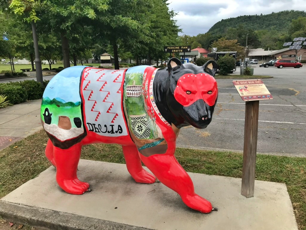
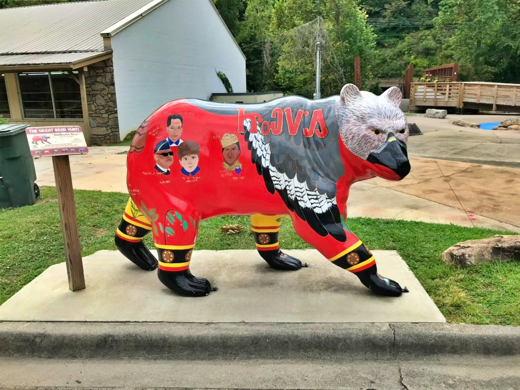
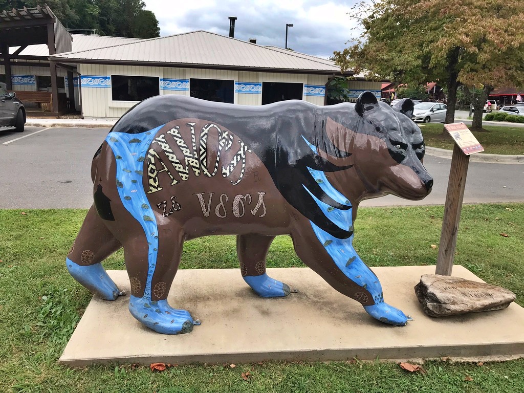
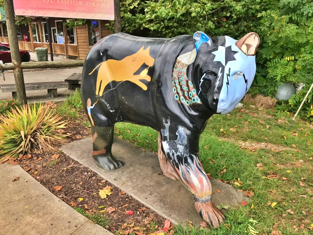
Scattered around downtown is a small, official self-guided trail called The Great Bear Hunt — seven painted bear statues in total, each one designed by a different local artist and paired with its own branded sign, plus a QR code and companion app for tracking down every one.
A quick heads-up if you go looking yourself: the app referenced on the signs appears to no longer be available, and depending on when you visit, some bears may have been moved, retired, or replaced. Treat the signs as a nice bonus if you happen to spot one rather than a guaranteed scavenger hunt. We didn’t manage to find all seven, but the ones we did stumble across were worth the stop:
Painttown Bear, painted by Nikki Nations
Birdtown Bear, painted by Alyne Stamper
Big Cove Bear, painted by Michelle Long & Carla Neadeau
Each of these three is named for a different traditional Cherokee community within the Qualla Boundary, and each had its own sign confirming the artist and title — worth reading if you come across one, since the details behind each design add a lot.
The Original Bears Project
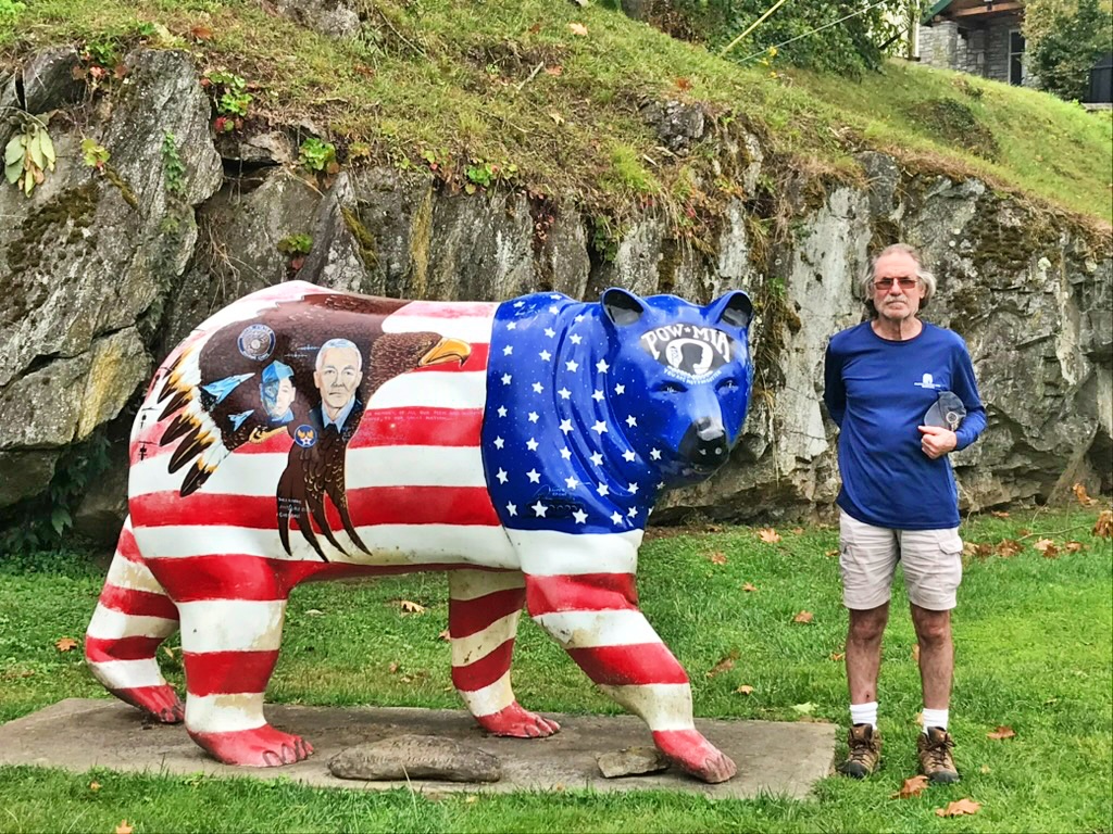
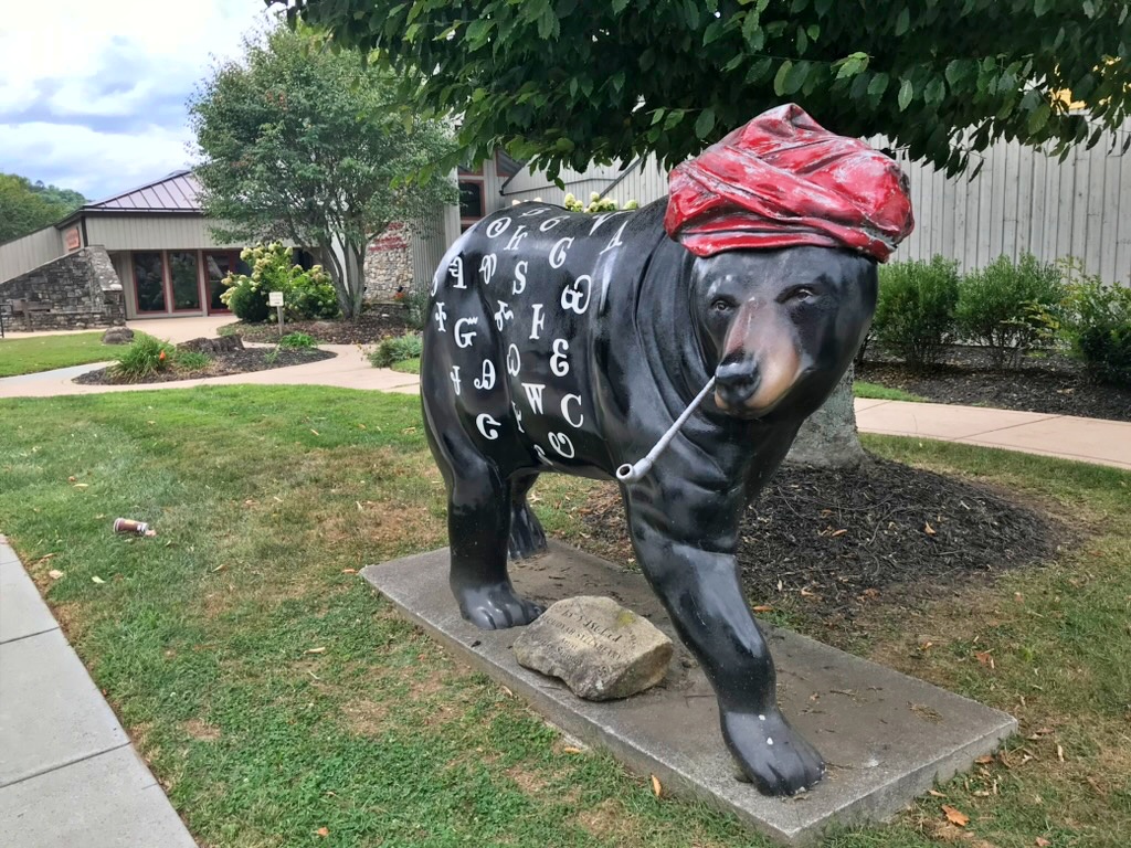
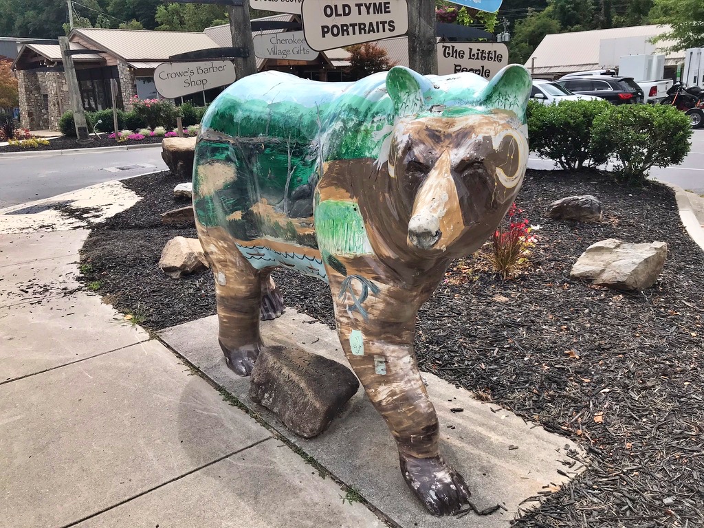
Separately from the Great Bear Hunt, Cherokee is also home to a much larger, older collection: the Bears Project, started in 2005 to showcase the range of talented artists within the Qualla Boundary. At its peak the project included around 20 painted bears spread across town, and while some have faded or been retired over the years, plenty are still standing. We came across a few favorites without even trying very hard to find them.
The Patriot Bear, found in Cherokee’s Veterans Park, is wrapped in a striking flag design with a POW/MIA emblem and portraits worked into the stripes — painted by William Harris Jr. as a tribute to Cherokee veterans.
Not far away, the Sequoyah Bear, painted by Charles Saunooke, is lettered in characters from the Cherokee syllabary, with a stone marker at its base explaining the writing system Sequoyah invented.
We also came across the Out of Hiber-Nation Bear, painted by Niki Nations, its coat depicting a forest and den scene symbolizing renewal and the bear’s emergence from hibernation, and the Legends Bear, painted by Henrietta Lambert, which weaves together imagery from several different Cherokee stories across a single design.
Beyond the Bears
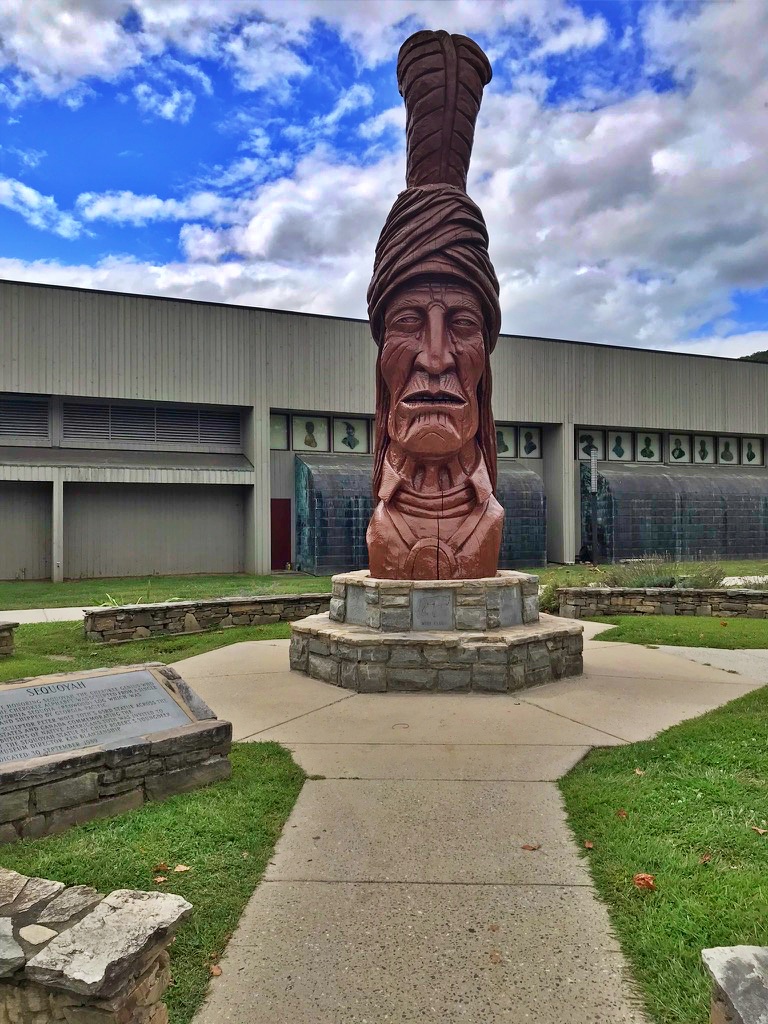
The Sequoyah theme doesn’t stop with the bear. Outside the Museum of the Cherokee People stands a 22-foot wooden bust of Sequoyah, carved from a single sequoia log by artist Peter “Wolf” Toth — part of his Whispering Giants series, sculptures placed in all 50 states to honor Native Americans. This one, dedicated in 1989, depicts Sequoyah with three carved tears representing the start of the Trail of Tears. Seeing both the wooden statue and the painted bear version within the same town, each honoring the same figure in a completely different medium, was a nice thread to follow.
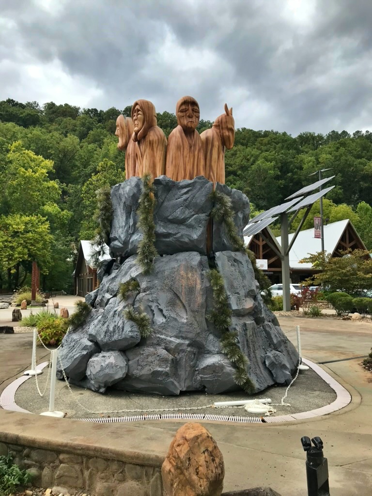
Elsewhere downtown, we came across a cluster of robed wooden figures rising from an artificial stone outcrop — the Statue of the Seven Clans, part of Cherokee’s broader Legends Exhibit, a series of public art installations paired with traditional Cherokee stories scattered throughout town. The seven figures represent the seven clans of Cherokee society (Bird, Blue, Deer, Long Hair, Paint, Wild Potato, and Wolf), each with its own role and responsibilities within the culture — a theme that shows up again and again around Cherokee, including on the base of the Sequoyah monument itself.
Between the bears, the statues, and the stories behind each one, Cherokee turned into more of a destination in its own right than we expected — worth building an extra hour or two into your day if you’re driving through on the Oconaluftee side of the park.
Where to Eat & Stay
Gatlinburg and Pigeon Forge are packed with restaurants, and while plenty lean toward the tourist-trap end of the spectrum, a few genuine gems stand out. Look for places serving Southern staples — country ham biscuits, buttermilk pancakes stacked high, and banana pudding that tastes like someone’s grandmother made it from scratch.
The Ole Smoky moonshine distilleries are also worth a stop for a tasting, whether you’re a spirits fan or just curious about the region’s rich history. It’s one of those only-in-the-Smokies experiences.
On the North Carolina side, Bryson City is a charming little town with a surprisingly good food scene for a place of its size. It’s also the home base for the Great Smoky Mountains Railroad, which makes for a wonderful afternoon excursion if you’re traveling with family.
Planning Tips Before You Go
– Reserve campsites and picnic pavilions at recreation.gov — they fill up fast in summer and fall
– Download offline maps before you go — cell service is spotty inside the park
– The Newfound Gap Road (US-441) is the main corridor through the park and stays open year-round unless there’s heavy snow
– Kuwohi Road (formerly Clingmans Dome) closes in winter, typically from December through March
– Arrive at popular trailheads before 9am in summer and fall to secure parking
A Few Things to Keep in Mind
The Smokies are bear country — black bears are active throughout the park and sightings are genuinely common. Always store food properly, never feed wildlife, and keep a respectful distance if you spot one on the trail. The park takes this seriously, and so should you.
Weather changes fast at elevation. Even in summer, pack a light rain jacket and layers if you’re heading above 5,000 feet. Afternoon thunderstorms are common in July and August, so plan to be off exposed ridges by early afternoon.
The Smokies aren’t a park you conquer in a weekend — they’re vast enough that even after days of driving, we still hadn’t seen it all. What we remember most isn’t any single overlook, but the rhythm of it: bears in the fields at dusk, fog that never lifted off Kuwohi no matter how many times we tried, and a mill and a herd of elk we almost didn’t make time for.