Theodore Roosevelt National Park — A Tale of Two Parks
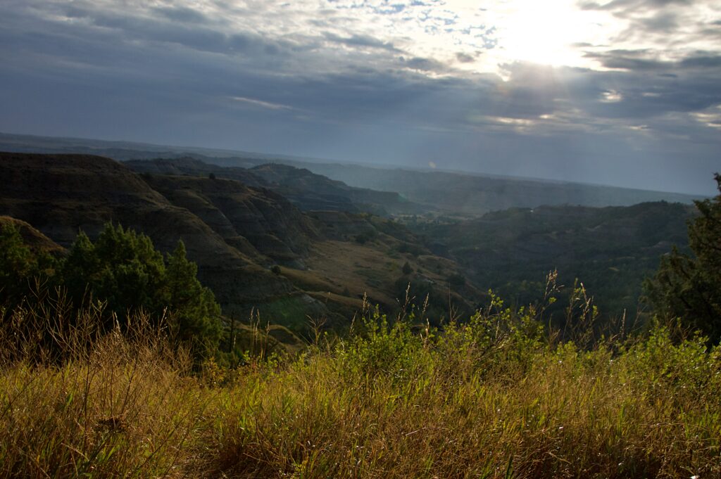
Early morning light breaking through as we entered the North Unit.
North Unit or South Unit? Here’s what nobody tells you before you go.
We chose Watford City over Medora for two reasons — the hotel was a little cheaper, and it put us closer to the North Unit, which was where we wanted to start. We were on the road before the sun was fully up, and by the time we reached the park entrance, the light was still low and gold, just starting to break through a heavy layer of clouds.
The North Unit: Quiet, Wild, and Full of Life
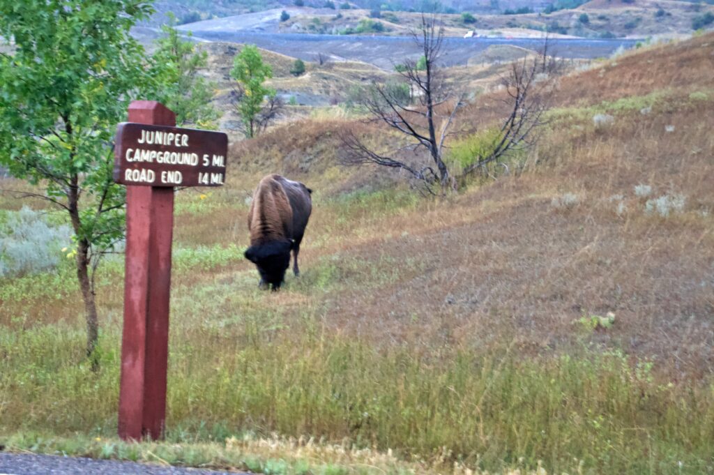
We hadn’t even made it past the entrance before our first bison sighting — grazing calmly, without a hint of hurry.
We hadn’t even made it past the entrance before we saw our first bison, grazing calmly along the roadside as if waiting to welcome us in. It set the tone for everything that followed — we didn’t have to search for wildlife in the North Unit. It simply kept appearing.
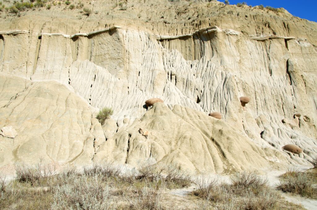
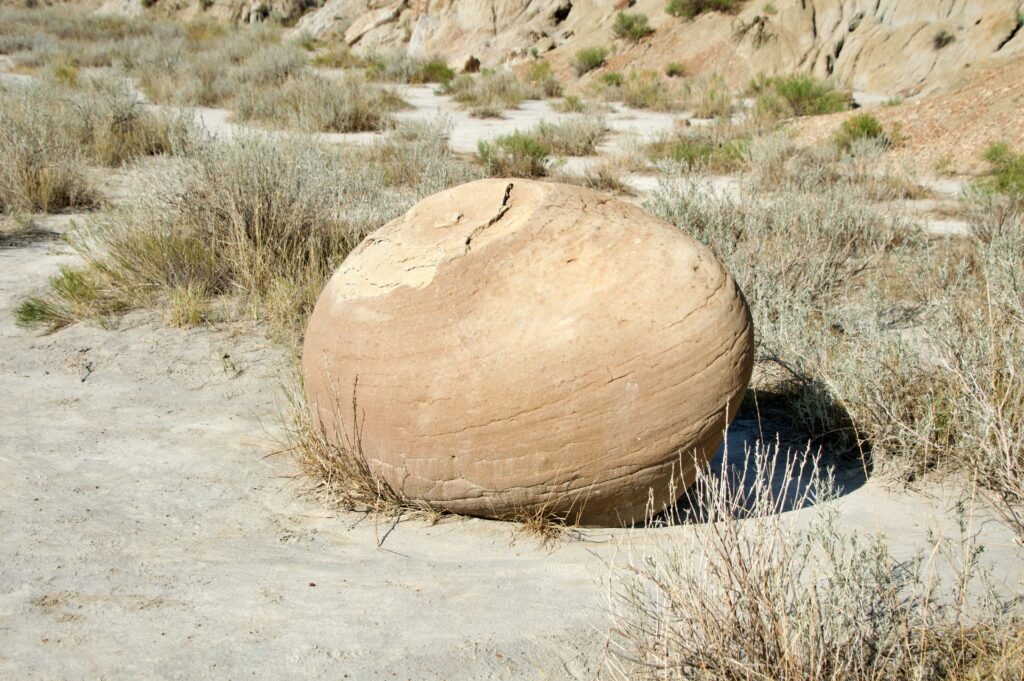
The Cannonball Concretions, unlike anything else we saw in the park — round, ball-like formations balanced on pedestals of their own making, pitted and strange against the blue sky.
The Cannonball Concretions pullout is the first stop most visitors reach, right off the road not far past the entrance. We actually saved it for the drive out instead, so we’ll come back to it.
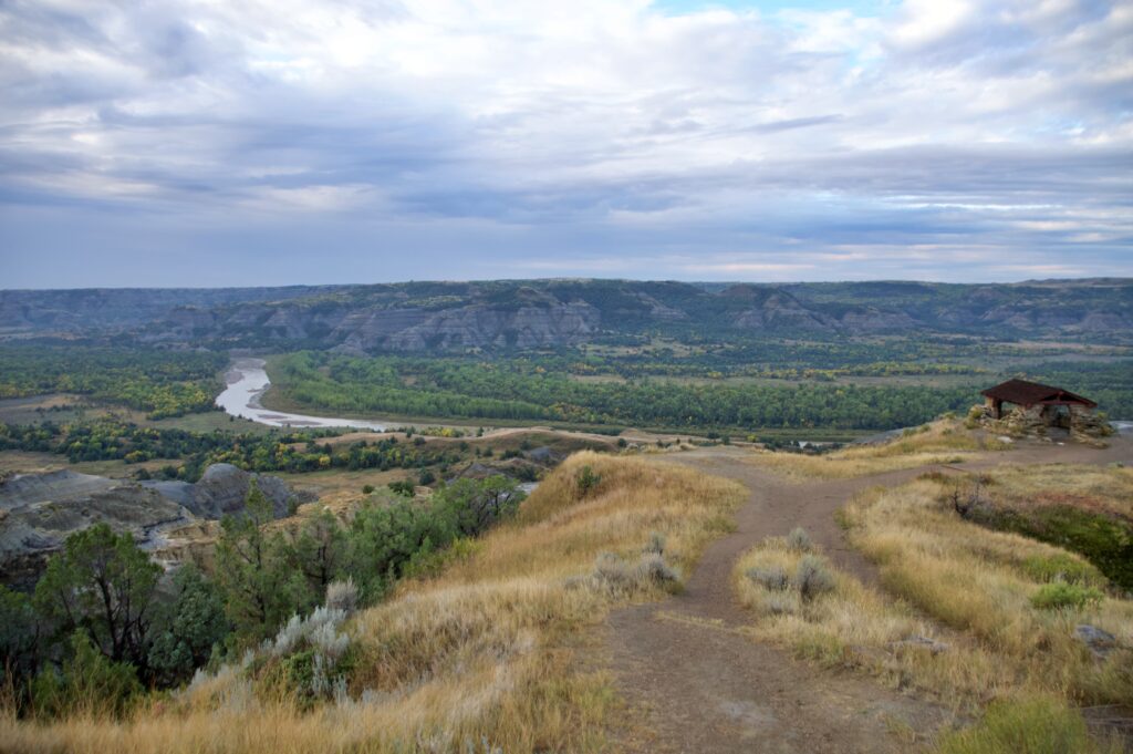
Skipping ahead first to River Bend Overlook, a short walk from the parking area brought us to one of the most iconic views in the entire park — a small stone shelter perched above a sweeping bend in the Little Missouri River.
River Bend Overlook — the trail leads to a stone shelter built in 1937, with the Little Missouri curving below.
That shelter was built in 1937 by young men of the Civilian Conservation Corps, part of Franklin Roosevelt’s New Deal relief program — a program that, in one of history’s small ironies, ended up honoring FDR’s own fifth cousin, Theodore Roosevelt, years before this land ever officially became a national park in his name.
The CCC men who worked here were between eighteen and twenty-five, camped along the Little Missouri not far from where we were standing, earning $30 a month with most of it sent straight home to their families back east. They quarried the local sandstone by hand — star drills, sledgehammers, and elbow grease — and built something that’s still standing, and still doing its job, nearly ninety years later.
Standing inside that shelter, looking out over the river far below, it wasn’t hard to understand why this spot became a favorite lookout even before any of that history happened here.
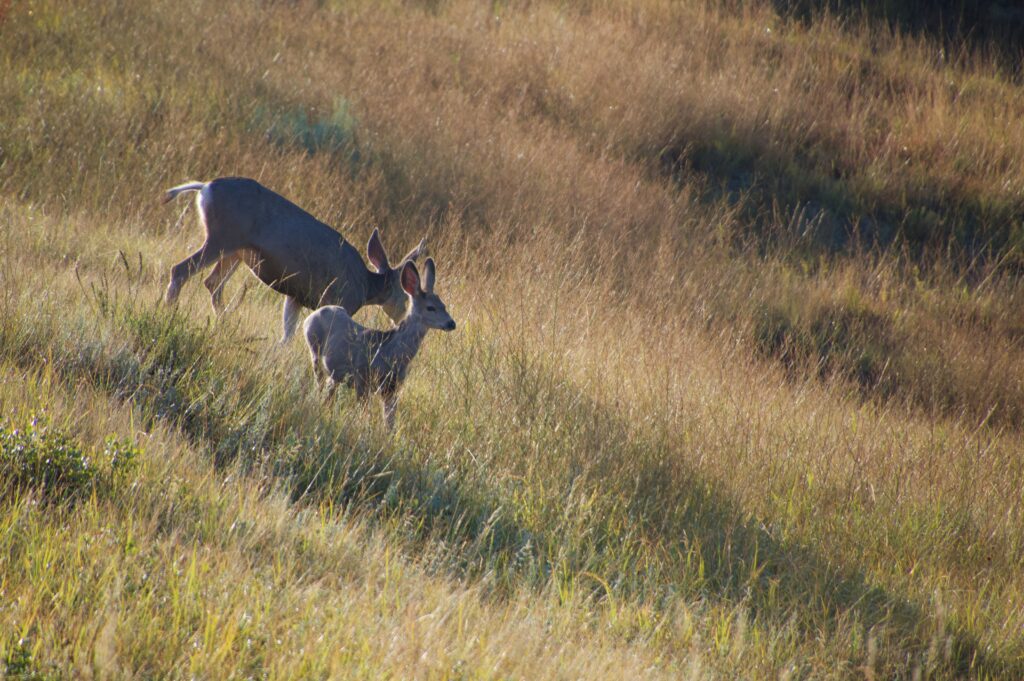
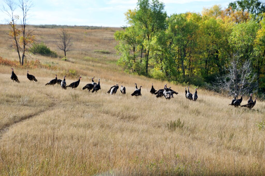
From there, the Scenic Drive continued west, and the wildlife kept showing up right on cue — a doe and her fawns stepping carefully through the sagebrush, barely pausing to notice us, and a little further on, an entire flock of wild turkeys working their way across a grassy hillside toward the tree line.
A doe and her fawn moving through the sagebrush, caught in the early morning golden light.
Not something we expected to see in the badlands — a flock of wild turkeys making their way toward the trees.
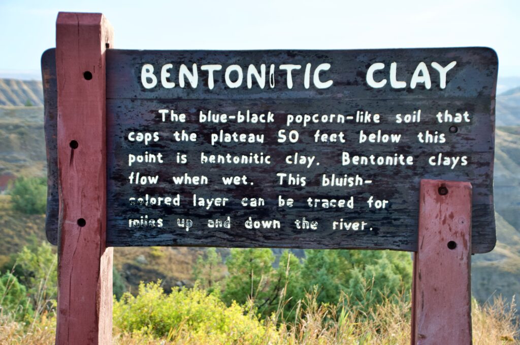
Along the way, a roadside sign marked the Bentonitic Clay Overlook, and it’s a stop worth actually reading, not just photographing.
A stop worth actually reading — this clay started out as volcanic ash millions of years ago, long before it ever looked like this.
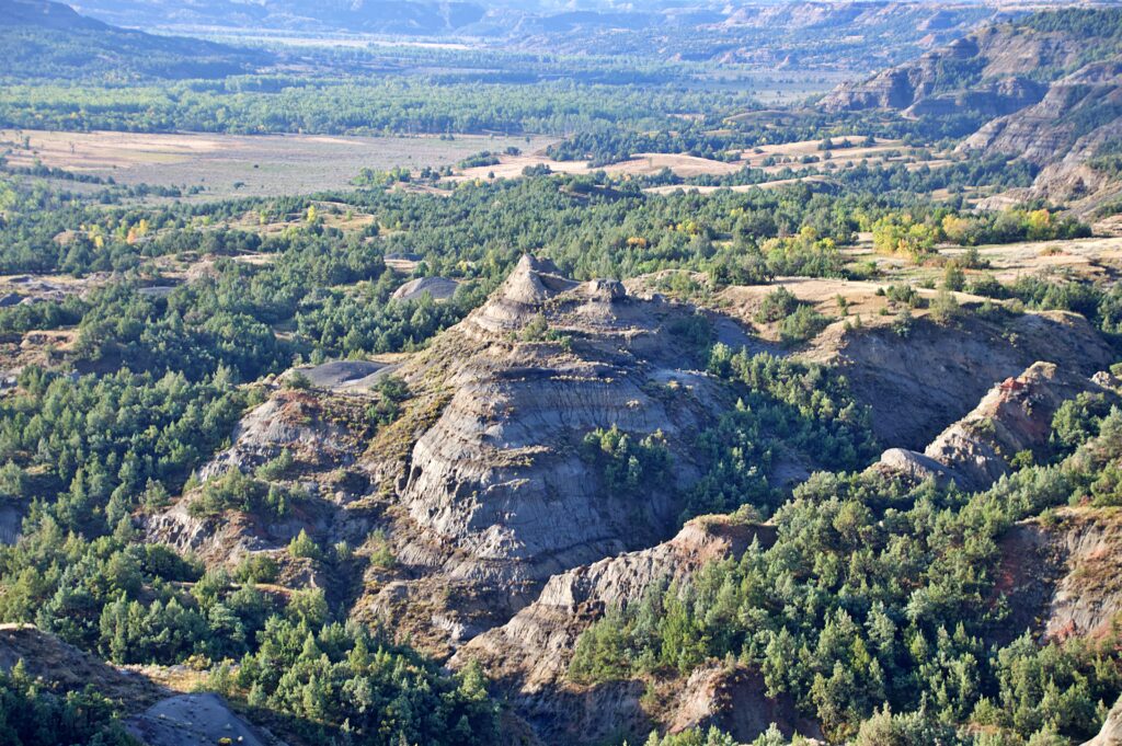
The blue-black, popcorn-textured clay capping the plateau below started out as volcanic ash — blown in from eruptions far to the west, tens of millions of years ago, settling into ancient lakes and swamps that no longer exist.
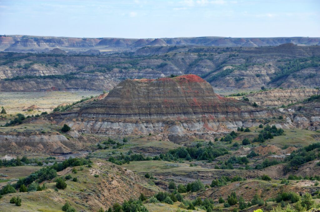
The view from the Bentonitic Clay Overlook — badlands rising out of a valley thick with pine and cottonwood, stretching out toward the horizon.
Over unimaginable stretches of time, that ash slowly transformed into the clay we were looking at, a layer the sign said can be traced for miles up and down the river. It’s strange to stand somewhere so quiet and think about how much has to happen, geologically speaking, just to get a hillside to turn that particular shade of blue-gray.
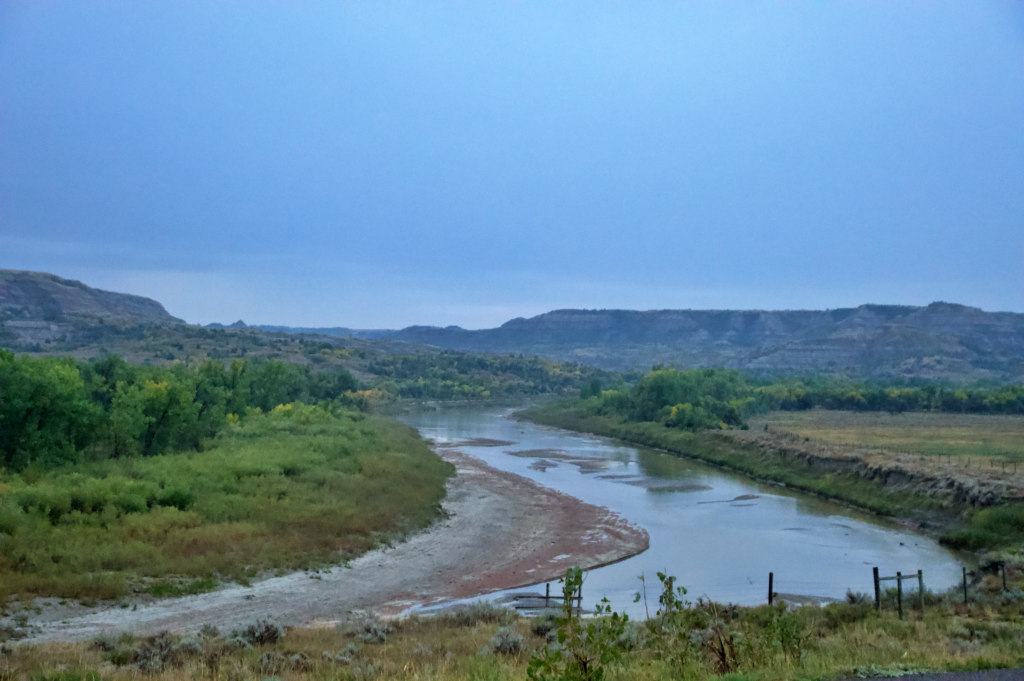
The Scenic Drive ends at Oxbow Overlook, where the Little Missouri makes a sharp, dramatic bend to the east. It’s a peaceful, almost meditative spot to end the drive — a good place to stand for a few extra minutes before turning back.
Oxbow Overlook, where the Little Missouri makes its sharp turn east — a quiet spot to end the Scenic Drive.
On our way out, we finally stopped at the Cannonball Concretions — and they were unlike anything else we saw in the park. Smooth, spherical boulders, some pitted with strange round holes, scattered across the landscape like something out of another world.
The Cannonball Concretions, unlike anything else we saw in the park — smooth, round, and pitted with holes that make them look almost otherworldly.
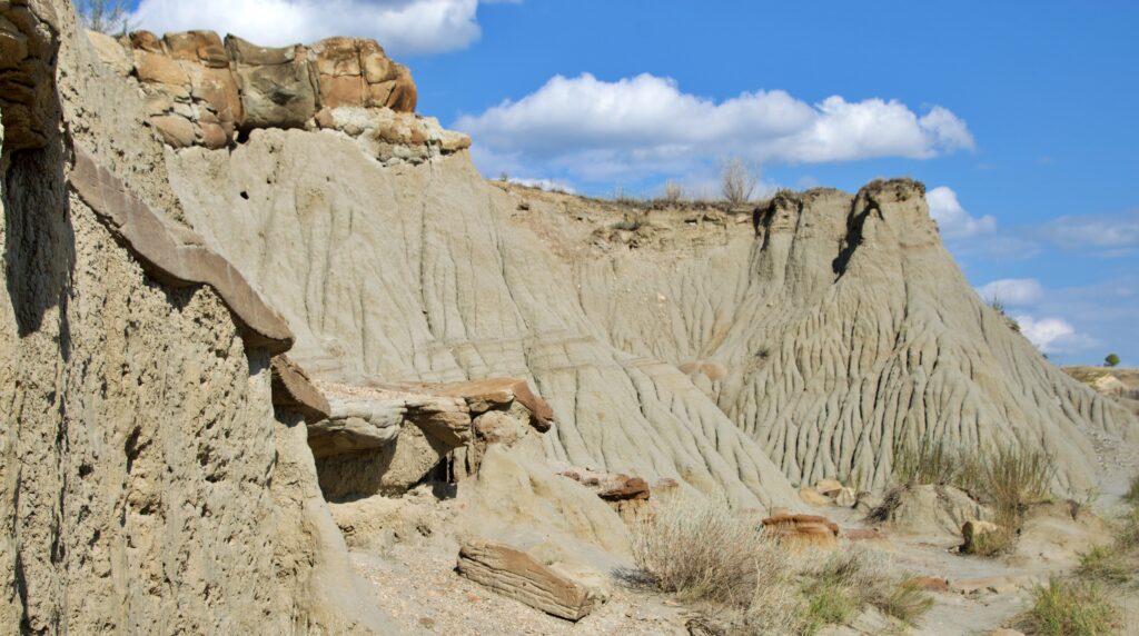
The badlands at work — wind and water carving these deep, rippled grooves with Cannonball Concretions.
If you’re visiting the North Unit, our advice is simple: stop here first. Most people do, and for good reason. We just happened to save the strangest formation in the park for last.
Leaving the North, Feeling the Shift
Leaving the North Unit, we had about two hours of driving ahead of us to reach the South Unit entrance near Medora — and somewhere along that drive, our phones quietly jumped forward an hour.
It’s easy to forget until it happens: the North Unit sits in Central Time, while the South Unit runs on Mountain Time, despite both belonging to the same park.
If you’re planning to visit both in a single day, it’s worth keeping that in mind when planning your trip so you don’t end up short on daylight without realizing why.
The South Unit: Bigger, Busier, Still Worth It
Painted Canyon Overlook — visible right off I-94, and often the first glimpse visitors get of the badlands before they’ve even entered the park.
The contrast hit us before we’d even reached the entrance. Painted Canyon Overlook sits right off I-94, just outside the South Unit boundary near Medora, and it’s often the very first thing visitors see — sweeping, colorful badlands opening up with almost no warning, visible from the highway itself. It’s a striking introduction, and a natural place to stop whether you’re just arriving or just leaving.
Once inside the park, the difference from the North Unit was immediate. More cars, more stops, more people pulled over with cameras — and within the first few miles, we found out why.
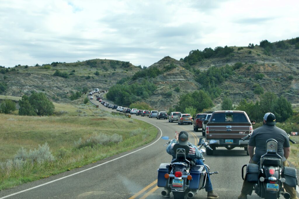
A classic South Unit bison jam — the whole herd claimed the road, and everyone just waited it out.
A herd of bison had taken over the Scenic Loop Road entirely, walking straight down the double yellow line while a line of cars, trucks, and even a couple of motorcycles idled behind them, in no particular hurry to go anywhere.
It’s a scene that plays out often enough here that there’s a name for it: a bison jam. Nobody seemed bothered by it. A few people had their windows down, phones out, waiting it out with the kind of patience that only makes sense in a place like this.
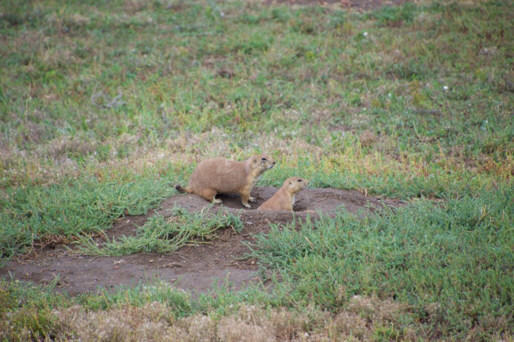
A little further along, we came across a prairie dog town near Cottonwood Campground — a whole colony of black-tailed prairie dogs popping up and down between their burrows, chirping at each other and at us in equal measure.
Black-tailed prairie dogs near Cottonwood Campground — the whole colony seemed to be chattering back and forth as we passed.
It’s easy to underestimate them next to something as big as a bison, but prairie dog towns like this one play a bigger role in the badlands than their size suggests — their burrowing turns over soil, and the colonies themselves become a food source for hawks, coyotes, and other wildlife that share this same stretch of grassland.
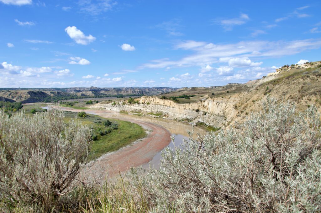
The stop we’d most looked forward to, though, was Wind Canyon Trail. It’s short — less than half a mile — but it climbs steadily, with a set of stairs near the top that make you feel like you’ve earned the view once you get there. And it is, without question, one of the best views in the entire South Unit: the Little Missouri River curling below a canyon carved not by water, like most of the badlands around it, but by wind.
The payoff at the top of Wind Canyon Trail — the Little Missouri curling below a canyon carved by wind.
Looking at the smooth, almost sculpted rock along the trail, it’s not hard to see why. Water tends to cut sharp, angular lines into rock. What wind leaves behind is softer, rounder — more like something worn down slowly, over and over, from every direction at once.
What We Missed
No matter how full a day feels, a park this size always leaves something on the table. For us, that was the wild horses — the South Unit is known for its free-roaming herd, and we’d hoped to spot at least a few grazing somewhere along the Scenic Loop Road. We didn’t see a single one. It happens. Wildlife doesn’t work on anyone’s itinerary, ours included.
We also didn’t make it out to Elkhorn Ranch, the park’s third and most remote unit, tucked between the North and South along the Little Missouri. It wasn’t a matter of difficulty — just time. With only one day to give the park, something had to give, and Elkhorn Ranch was it. It’s reachable from either unit if you build extra time into your visit, and it’s already at the top of our list for next time.
One Park, Two Very Different Days
Looking back, what stayed with us wasn’t just what we saw, but how differently the two units made us feel while seeing it.
The North Unit was truly magical. Empty roads, early light, wildlife that simply appeared without being sought — it drew us in, narrowing our focus to whatever was right in front of us: a shelter built by hand ninety years ago, a hillside of clay that used to be volcanic ash, a bend in a river that took a glacier to create.
The South Unit was the opposite. It opened things up — more traffic, more stops, more of that classic badlands scale that photographs can never quite capture. Bison jams and busy overlooks aside, it’s the unit that gives you the wide, unmistakable feeling of standing in Theodore Roosevelt’s badlands, the ones he wrote about, the ones that shaped how he thought about the American wilderness for the rest of his life.
We’re glad we did both, and in that order. If you only have one day, we’d make the same choice again: start where it’s quiet, end where it’s grand — and don’t be surprised if, like us, you leave already planning the trip back to see what you missed.
Ready to plan your own visit? We put together a full guide covering fees, trail lengths, when to go, where to stay, and everything else we wish we’d known before our trip — including how to avoid getting caught off guard by that time zone change. Read the Theodore Roosevelt National Park Travel Guide →