Route 66 in Missouri is where the road begins to leave its urban origins behind and open into a broader landscape of hills, small towns, and roadside traditions. In this stretch, the journey feels less like a departure point as Route 66 settles into a rhythm, with small towns interspersed among cities that helped shape the culture that defines the road.
This page highlights selected locations and experiences along Route 66 in Missouri, focusing on places that reflect the character of the route rather than attempting to document every stop along the way.
The Character of Route 66 in Missouri
Route 66 in Missouri settles into itself. The road moves at a slower, more grounded pace, shaped by natural terrain and communities that developed along its path. Rolling hills, stretches of forest, and historic towns create a sense of continuity that feels distinctly different from the dense beginnings in Illinois.
This portion of the route reflects Route 66 as both a working road and a cultural corridor, where travelers are met not just with destinations, but with the steady presence of places built to serve them.
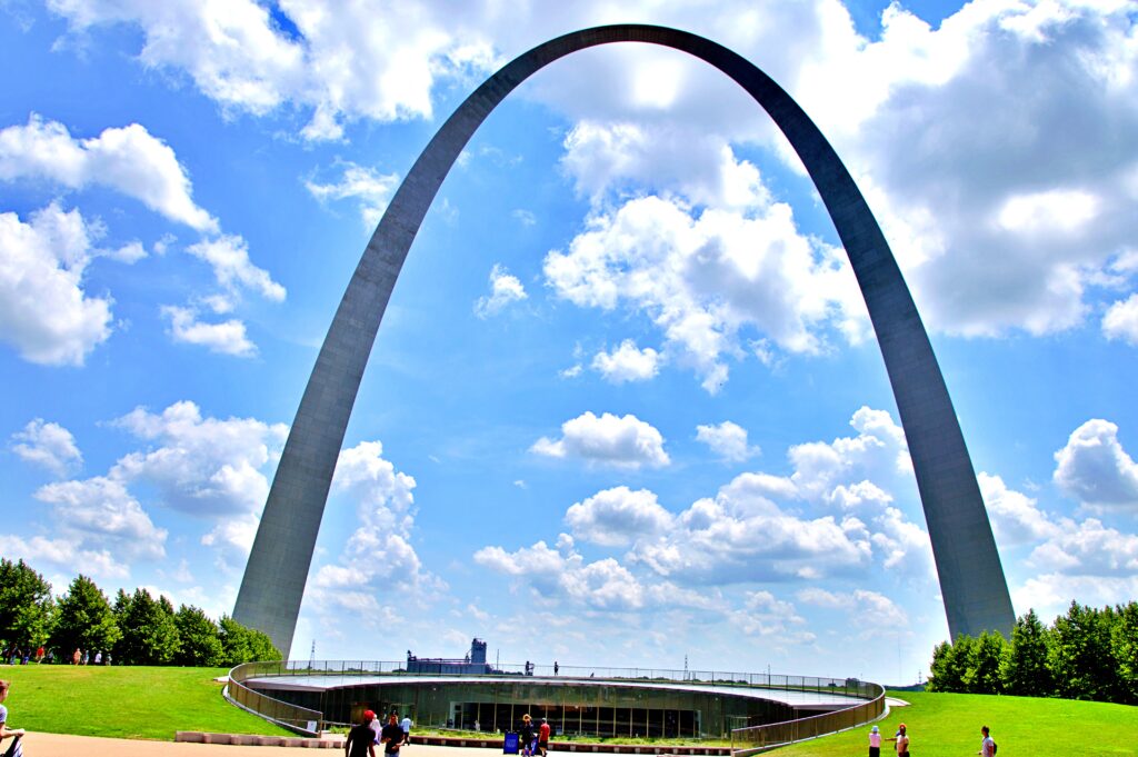
Gateway Arch – St. Louis
The Gateway Arch in St. Louis marks a symbolic threshold along Route 66, where the journey begins to open toward distance and the idea of the American West.
Marking the symbolic “Gateway to the West,” the Gateway Arch sits near where Route 66 crosses the Mississippi River. While not specific to the road itself, it frames the moment when the journey begins to shift toward longer distances and broader horizons
Chain of Rocks Bridge — St. Louis
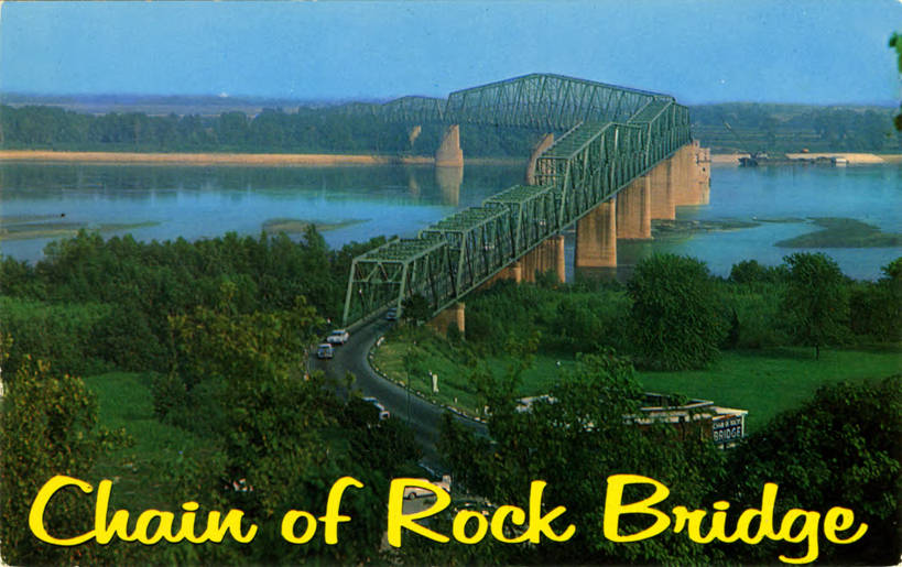
The Chain of Rocks Bridge stands as one of the most distinctive crossings along Route 66, known for its unusual 22-degree bend partway across the Mississippi River. Once a vital link carrying travelers westward, the bridge now serves as a pedestrian and cycling path, offering a quieter way to experience a piece of the road’s history.
A vintage postcard captures the Chain of Rocks Bridge and its famous bend across the Mississippi River. Photo: See Chain of Rocks page for author, Public domain, via Wikimedia Commons
Suspended above the river, it reflects both the engineering ingenuity of its time and the evolving nature of Route 66—where movement has shifted from necessity to preservation and reflection.
From the span, the Gateway Arch is faintly visible to the south, a distant reminder of St. Louis and the broader journey tied together by the Mississippi River.
Meramec Caverns — Stanton
Meramec Caverns offers a shift away from the open road, carrying the Route 66 experience beneath the surface into a landscape shaped by time and stone. Inside, wide chambers and intricate formations create a sense of stillness that contrasts with the movement of the highway.
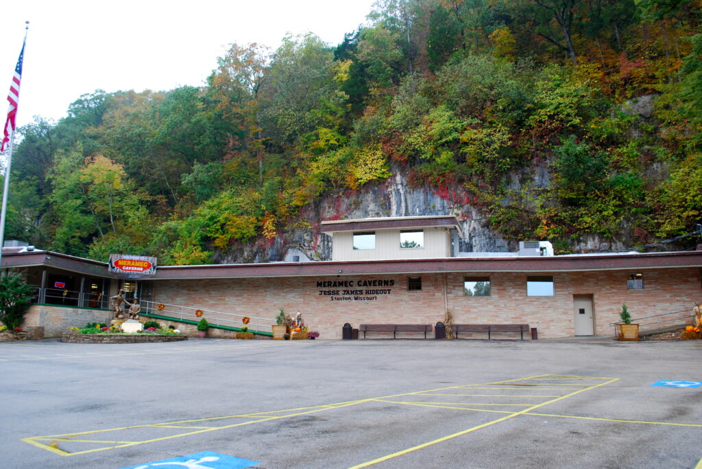
Meramec Caverns in Stanton, Missouri, promoted for decades as a hideout of outlaw Jesse James. Photo: Ronincmc, CC BY-SA 4.0 https://creativecommons.org/licenses/by-sa/4.0, via Wikimedia Commons
Long associated with the legend of Jesse James using the caverns as a hideout, the story added to the site’s allure, encouraging travelers to stop and helping establish it as one of the most popular destinations along Route 66.
Much of that popularity was no accident. Meramec Caverns is widely credited as a pioneer of American barn advertising — painting its name across the roofs and sides of barns for miles in every direction, a marketing tactic that became so effective other roadside attractions across the country began copying it. If the painted barn you spotted back in Cayuga, Illinois, looked familiar, that’s why: it followed the same playbook Meramec Caverns helped popularize decades earlier.
Wagon Wheel Motel — Cuba
The Wagon Wheel Motel in Cuba stands as one of the oldest continuously operating motels along Route 66, offering a glimpse into the early days of roadside travel.
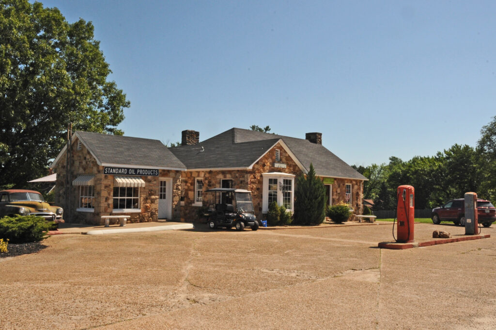
The Wagon Wheel Motel’s stone office and station in Cuba, Missouri. Photo: KLOTZ, CC BY-SA 4.0 https://creativecommons.org/licenses/by-sa/4.0, via Wikimedia Commons
With its stone cottages and restored neon sign, the property reflects a time when accommodations were designed with both function and individuality in mind. More than just a place to stay, the motel represents the era when Route 66 was defined by independently owned stops, where travelers could find character, hospitality, and a sense of place rooted in the road itself.
Route 66 Murals — Cuba
The Route 66 murals in Cuba turn the town into a canvas of shared history, where scenes of travel, heritage, and everyday life unfold across building walls.
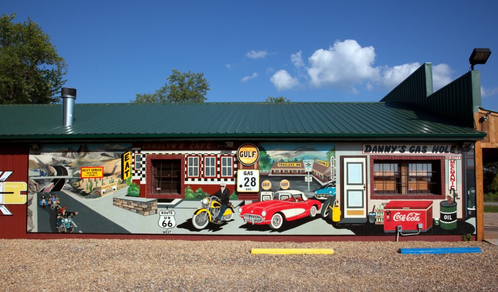
One of Cuba’s Route 66 murals depicts a nostalgic roadside scene — earning the town its nickname, “Route 66 Mural City.” Photo: Carol M. Highsmith, Public domain, via Wikimedia Commons
As “Mural City,” Cuba offers a different kind of roadside experience—one that invites travelers to slow down and engage with the stories embedded in the landscape. Here, Route 66 is expressed not only through the road itself, but through the images that preserve and interpret its meaning.
Outlaws, Murals & the Last Missouri Mile – Joplin
Joplin sits near the far southwestern corner of Missouri, the last major stop on Route 66 before the highway crosses into Kansas. It’s not a town most people associate with the Mother Road’s classic imagery — no giant sculptures, no neon motel signs — but it holds one of the most notorious true-crime stories connected to the highway, and a genuinely well-done tribute to Route 66 itself.
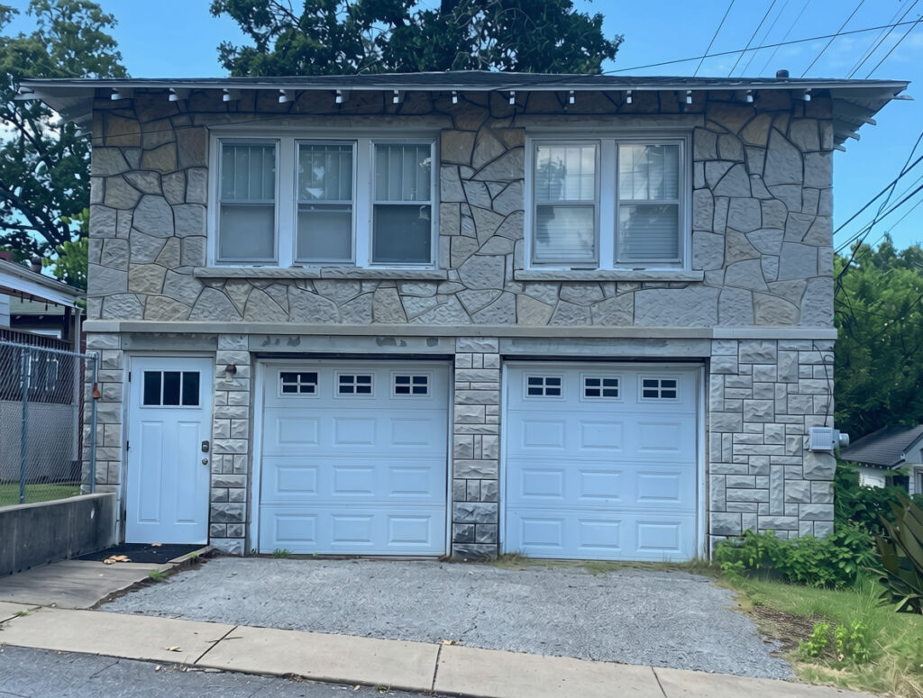
The Bonnie and Clyde Garage Apartment
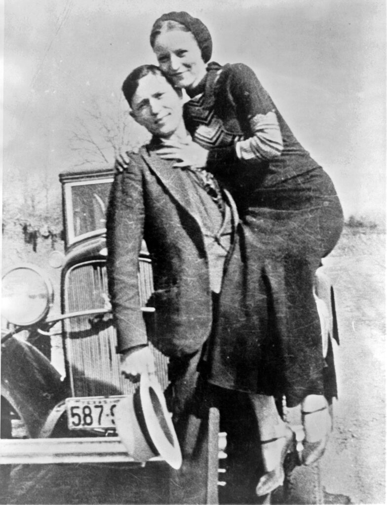
Bonnie Parker and Clyde Barrow, photographed in the early 1930s — one of the images developed from the film the pair left behind after their narrow escape from the Joplin apartment.
In April 1933, Bonnie Parker and Clyde Barrow rented a modest garage apartment on Joplin’s south side under a false name, using it as a hideout while Clyde’s brother Buck was reunited with the gang after his release from prison. For nearly two weeks, the group kept a low profile — playing cards, drinking newly legal beer, and occasionally slipping out to the movies — until suspicious neighbors alerted police to the comings and goings next door.
Bonnie Parker and Clyde Barrow, photographed in the early 1930s — one of the images developed from the film the pair left behind after their narrow escape from the Joplin apartment. Library of Congress, Public domain, via Wikimedia Commons.
On April 13, officers arrived expecting to find bootleggers. Instead, they were met with automatic weapons fire. Constable Wes Harryman and Detective Harry McGinnis were killed in the shootout, and the gang escaped — but not before leaving behind a roll of undeveloped film. When the local newspaper processed it, the images that emerged became some of the most iconic photographs of the pair ever taken, including the now-famous shot of Bonnie posed with a cigar and a pistol. Those photos helped transform Bonnie and Clyde from regional outlaws into national legends.
The apartment still stands today, added to the National Register of Historic Places in 2009. It’s privately owned and now operates as a short-term rental — you can actually spend the night in the same rooms where the shootout took place.
Route 66 Mural Park
A few miles away in downtown Joplin, Route 66 Mural Park does the opposite of hiding history — it puts it right on the wall. The park sits on the south side of the old Pearl Bros. hardware building, at a corner where Route 66 once shifted west toward Kansas.
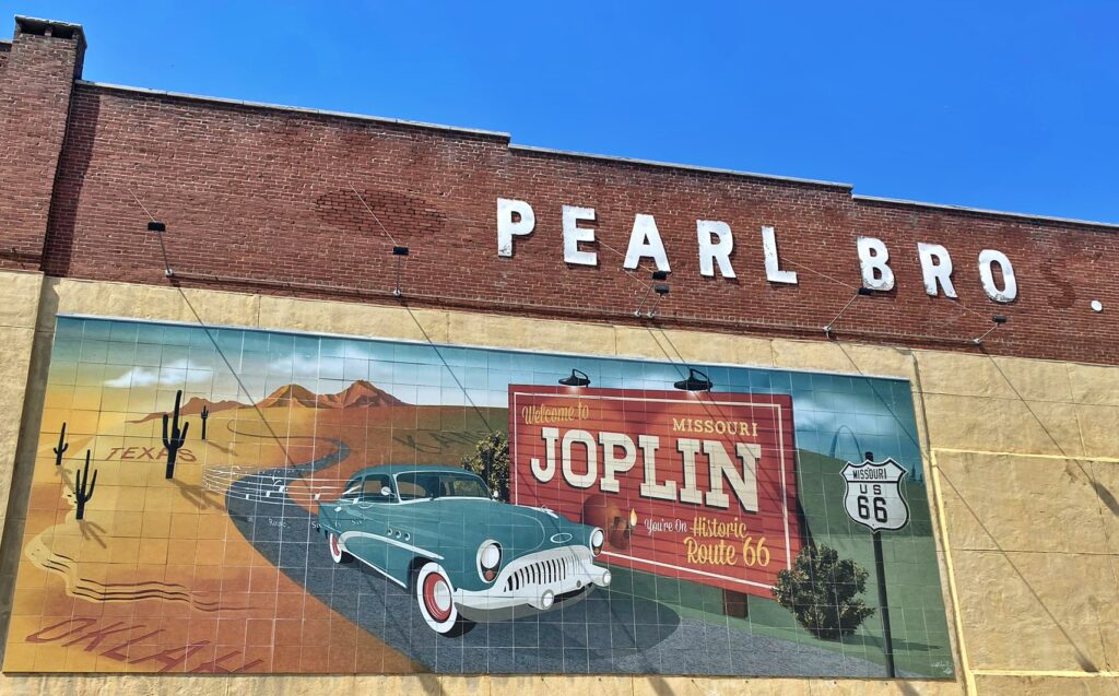
Painted across the side of the old Pearl Bros. building in downtown Joplin, this tile mural—known as “Cruisin’ into Joplin”—welcomes travelers to the Missouri stretch of Route 66.
The first mural, painted on the Pearl Bros. building itself, is called Cruisin’ into Joplin — a vintage car cruising past cactus and desert scenery toward a “Welcome to Joplin, Missouri” sign, a nod to the highway’s full stretch through very different landscapes.
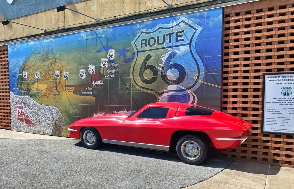
A life-sized replica Corvette poses in front of “The American Ribbon” mural at Joplin’s Mural Park, tracing the highway’s full path from Chicago to Santa Monica — with Joplin marked right along the route.
Around the corner, The American Ribbon traces the entire route from Chicago to Santa Monica across a tiled map, with a bisected replica 1963 Corvette jutting out of the wall as a built-in photo op — as if the car is driving straight out of the mural.
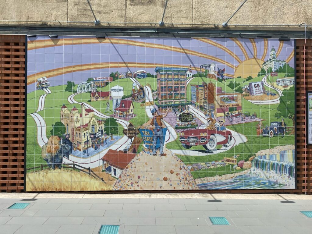
A sweeping tile mural at Joplin’s Mural Park illustrates the city’s Route 66 history and local landmarks — packed with local references for anyone willing to look closely.
The newest addition, added in 2025, is a sweeping panoramic mural depicting Joplin’s Route 66 and mining-era history — local landmarks like the Fox Theatre, Grand Falls, and the old Katy railroad line woven together with a bit of small-town whimsy.
Together, the three murals turn a once-neglected downtown parking lot into one of the most photographed stops in this stretch of Missouri — proof that Route 66 nostalgia isn’t only about what survived from the highway’s heyday, but also what towns have chosen to build since.
Roadside Culture & Landmarks
Missouri’s Route 66 culture leans into preservation and continuity. Classic motels, diners, and service stations remain in use or have been restored with care, maintaining a visual and functional connection to earlier eras of travel.
Rather than isolated novelty, these landmarks feel embedded within their communities, reinforcing the idea that Route 66 developed as part of everyday life rather than as a series of attractions.
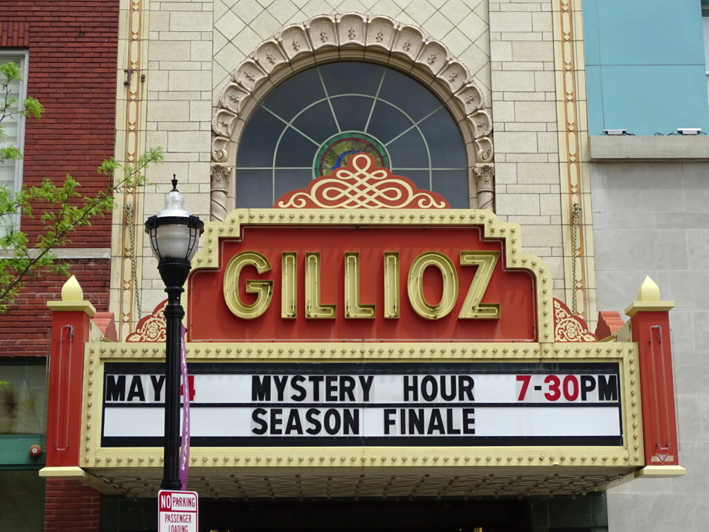
Springfield’s Gillioz Theatre captures that spirit well. Opened in October 1926 — the same year Route 66 was officially named, in a proposal made just blocks away — the theater’s builder, M.E. Gillioz, secured a narrow strip of leased frontage directly on the highway corridor specifically to draw travelers passing through.
The Gillioz Theatre has lit up St. Louis Street in Springfield since 1926. Photo: Adam Jones from Kelowna, BC, Canada, CC BY-SA 2.0 https://creativecommons.org/licenses/by-sa/2.0, via Wikimedia Commons
Nearly a century later, the theater still anchors downtown Springfield, restored and active, its ornate marquee lighting up the same street the Mother Road once ran down. It’s less a roadside curiosity than a landmark that grew up alongside the highway itself, which is really the throughline of Missouri’s whole approach to Route 66.
Traveling Through Missouri
Traveling Route 66 through Missouri involves a mix of historic alignments and modern roadways, with segments that weave through towns as well as quieter stretches between them. The terrain introduces gentle curves and elevation changes, adding variation to the drive.
Distances between stops become slightly longer than in Illinois, but the spacing still allows for an unhurried pace, making it possible to experience multiple towns within a single day.