Petit Jean State Park: Arkansas’ First, and Still One of Its Best
Arkansas’ first state park, and the waterfall that made us understand why
We didn’t have to drive far for this one, and that’s part of what I love about it. Petit Jean Mountain sits close enough to home that it almost feels unfair to call it a road trip — and yet every time we go, it feels like we’ve found somewhere completely removed from everyday life. We went this spring, timing it so the creek would still be running high from winter and early rain, and it did not disappoint.
This was a two-trail day: the Cedar Creek Trail first, then down into the canyon on the Cedar Falls Trail to stand at the base of the waterfall that gives the park its reputation. Here’s what that day looked like, and everything you need to know before you go do it yourself.
A Little Petit Jean History
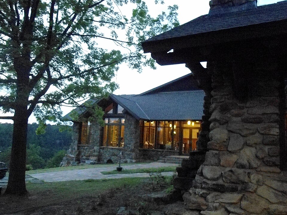
Petit Jean State Park holds a special title: it’s Arkansas’ very first state park, established back in 1907 after a local physician campaigned to protect the mountain from timber and coal interests. That early preservation effort is a big part of why the park feels the way it does today — the Civilian Conservation Corps came through in the 1930s and built much of what you’ll still walk on, drive past, and stay in, including Mather Lodge, the rustic stone-and-timber lodge perched on the canyon rim that serves as the starting point for the hike down to the falls.
Mather Lodge, built by the CCC in the 1930s, sits right on the canyon rim and marks the start of the Cedar Falls Trail. Photo: Brandonrush, CC BY-SA 3.0, via Wikimedia Commons
The mountain’s name comes from a local legend — the story of a young French girl named Jean who disguised herself as a boy to stow away on her fiancé’s ship bound for the Arkansas territory, only to fall ill and be buried on the bluff overlooking the river valley below. True or not, it’s the kind of story that sticks with you a little as you’re hiking through the same canyon she’s said to be watching over.
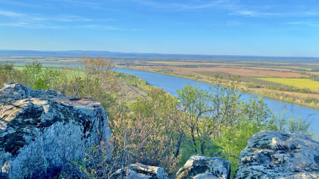
The view from Petit Jean Lookout stretches across the Arkansas River valley far below the bluff.
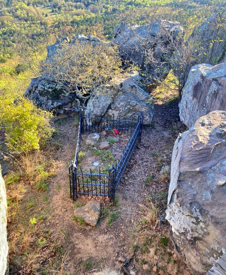
We made a point of stopping at Petit Jean Lookout, a short walk from the parking area near the grave itself. The view from up there stops you in your tracks — the Arkansas River winds through the valley far below, and on a clear day you can see for miles across the farmland and hills that stretch out from the base of the mountain. It’s one thing to read the legend on a plaque, and another to stand at the same bluff and understand exactly why she — or whoever she really was — would have chosen this spot to be laid to rest. Her grave sits quietly nearby, simple and easy to miss if you’re not looking for it, which somehow makes it more moving.
Petit Jean’s grave sits quietly near the lookout, overlooking the same valley she’s said to have loved.
Cedar Creek Trail
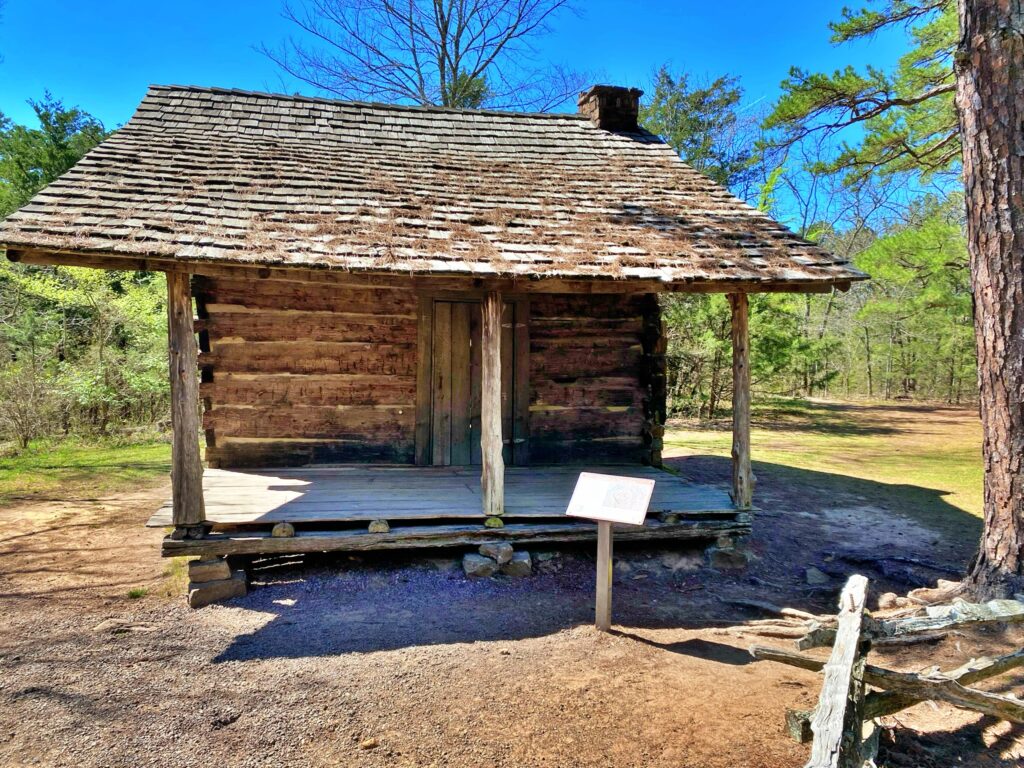
One thing worth clearing up before you go, because it tripped us up too: Cedar Creek Trail and Cedar Falls Trail do not share a trailhead. Cedar Falls Trail starts behind Mather Lodge — that’s the one most people are looking for. Cedar Creek Trail actually starts at the Pioneer Cabin, a separate spot in the park, and it’s an easy mix-up to make if you’re relying on a map alone.
The Pioneer Cabin, dated to 1857 and relocated to this site by the CCC in 1937, marks the start of the Cedar Creek Trail — not to be confused with the Cedar Falls trailhead at Mather Lodge.
The cabin itself is worth a few minutes on its own. Dendrochronology testing done in 2022 dated the wood to 1857, or shortly after, making it more than 150 years old. It’s a simple, one-room log structure, typical of the rural homes built by farming families settling Petit Jean Mountain and the surrounding area in the mid-1800s — the kind of house that would have sheltered a large family in a single room. It originally stood on the north side of Cedar Creek, not far from today’s visitor center, before the Civilian Conservation Corps’ Camp V-1781 relocated it to its current site in 1937 and dedicated it as one of the park’s historical highlights.
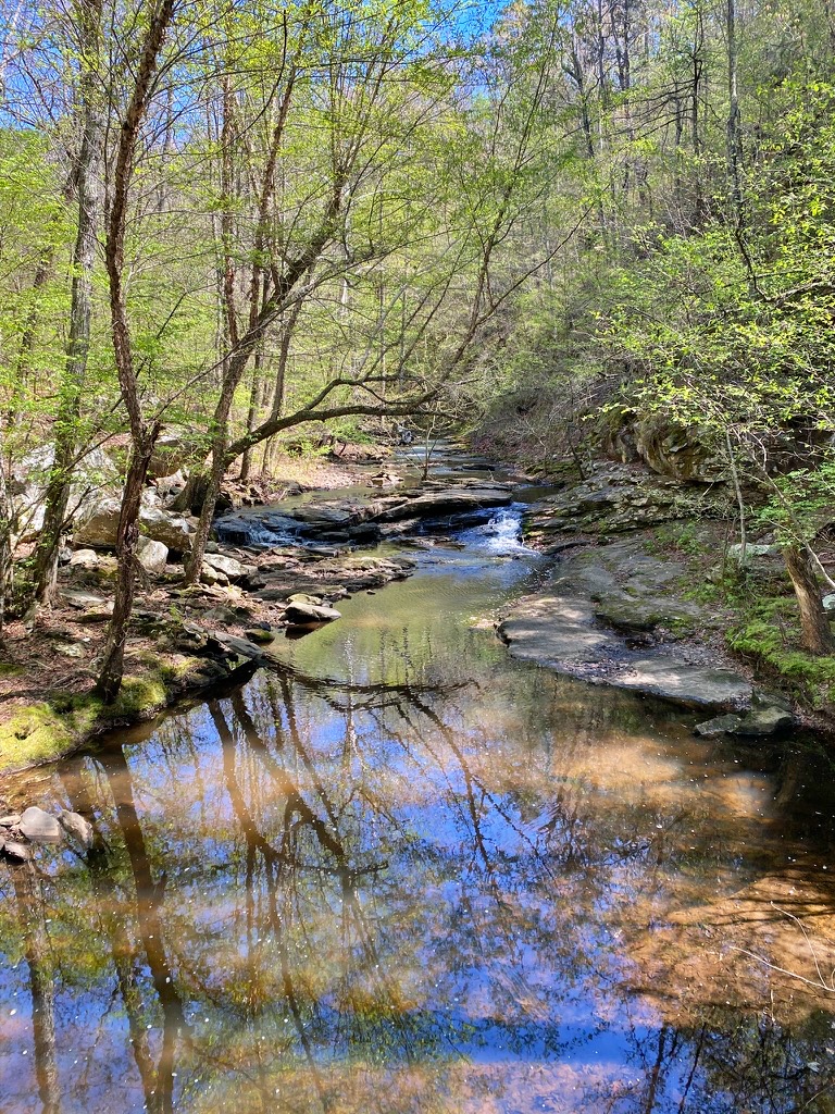
From the cabin, Cedar Creek Trail is a roughly 1.25-mile loop that stays up along the rim and both sides of the creek above the falls. It’s an easy-to-moderate walk — a nice warm-up before the steeper trail to come — and it gave us a completely different perspective on the same water we’d be standing beneath an hour later. There are a few small cascades along this stretch of the creek, bluff-top views up and down the canyon, and a genuinely peaceful feel to it, especially if you go early enough to beat the day-trippers who head straight for the falls.
Cedar Creek Trail runs along the rim and creek above the falls, with a handful of small cascades of its own.
This trail also connects to the Boy Scout Trail, which gives you a view of Cedar Falls from the opposite side of the canyon — a nice option if you want a different vantage point without committing to the full descent, though we saved that for the main event.
Cedar Falls Trail
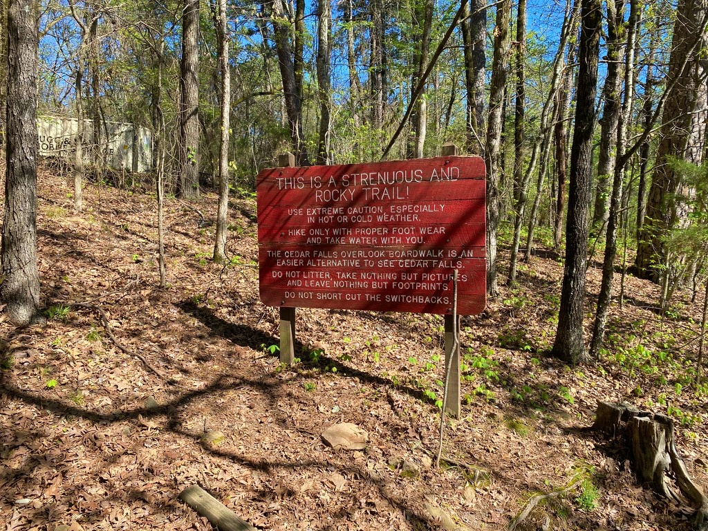
From behind Mather Lodge, the Cedar Falls Trail drops immediately into the canyon — and I do mean immediately. The trail loses roughly 200 feet of elevation in the first quarter mile or so, switchbacking down a rocky, CCC-built path that’s held up remarkably well for something built nearly a century ago. There’s a warning sign at the trailhead about the climb back out being strenuous, and I won’t pretend it’s nothing, but it’s manageable if you pace yourself. We passed families with young kids making the trip just fine.
The trailhead doesn’t hide the ball — this sign means it. The switchbacks down to Cedar Falls are steep and rocky, and there’s an easier boardwalk overlook option if you’d rather skip the descent.
Once you’re down in the canyon, the trail levels out and follows Cedar Creek upstream for the rest of the way — a genuinely lovely stretch, shaded and green, with the sound of the creek keeping you company the whole time. All told, it’s about a mile each way, just under two miles round trip.
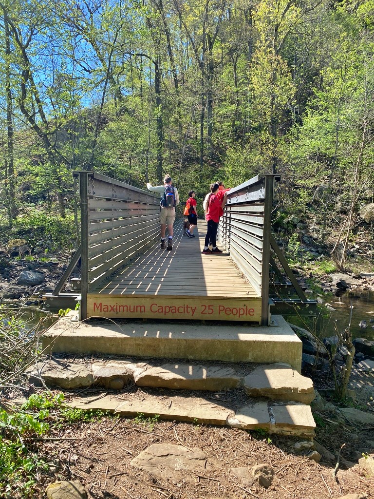
The trail levels out once you’re down in the canyon, crossing Cedar Creek on a footbridge before following the water upstream toward the falls.
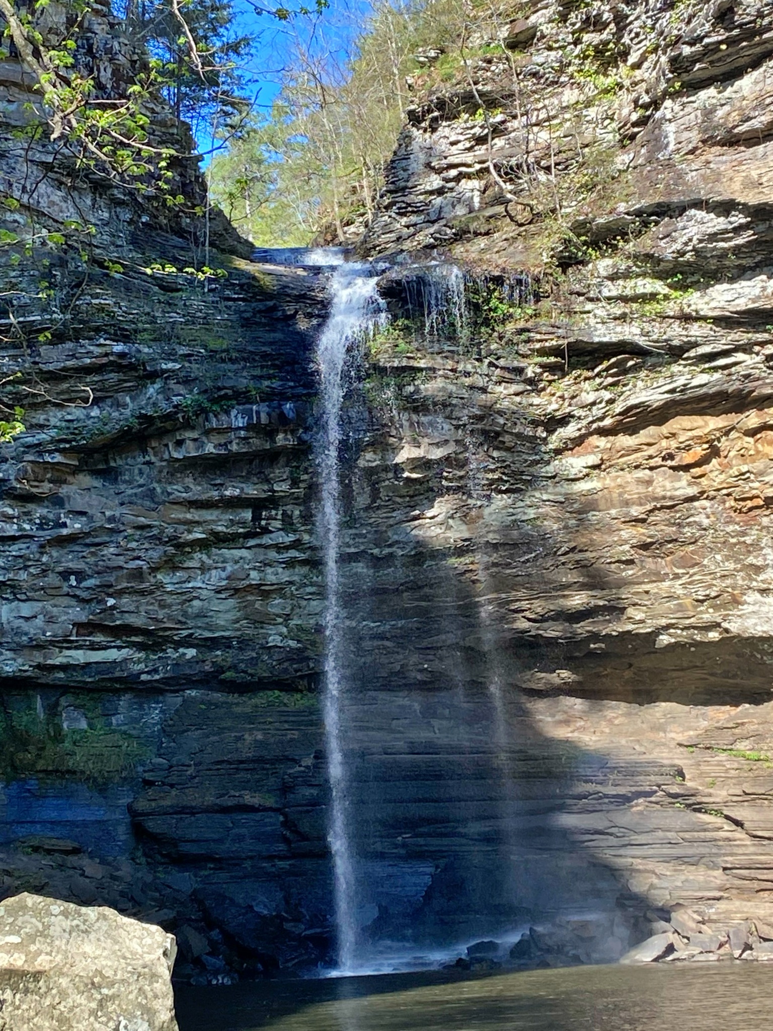
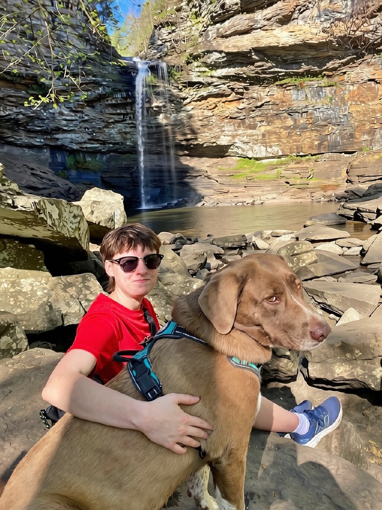
And then you round a bend and there it is: Cedar Falls, dropping 95 feet into a wide, boulder-strewn grotto. Photos don’t do it justice — the scale of it, the sound, the cool mist drifting off the pool at the base. It had been a drier spring than usual, and the flow was a little lower than I’d hoped for, though a good rain earlier that week had at least kept it running steadily rather than reduced to a trickle. Even at less than full force, it’s an impressive sight. I’d love to see it after a heavier rain sometime. You can scramble around the basin on either side, and if conditions allow, you can even make your way behind the falls itself. We spent a long time just sitting on the boulders near the base, not in any hurry to start the climb back out.
No rush to leave — the base of the falls made a pretty good spot to sit for a while, dog included.
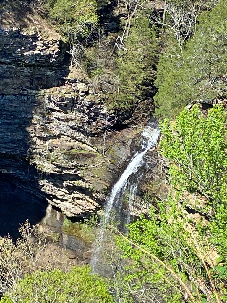
If the climb down (and, more importantly, back up) isn’t something you’re up for, you don’t have to miss the falls entirely. There’s an accessible overlook boardwalk near the top of the canyon that gives you a bird’s-eye view straight down onto Cedar Falls from above — no scrambling required. It’s a great option for older visitors, anyone with mobility limitations, or honestly anyone who just wants the view without the workout. We stopped here too, and the vantage point down into the canyon is stunning in its own right, seeing the whole scale of the falls and the rock walls around it at once.
The overlook boardwalk gives you a bird’s-eye view straight down onto Cedar Falls, no hiking required.
Planning Tips Before You Go
Wear real hiking shoes or boots with good tread — the descent is rocky, and it gets slicker near the falls where there’s spray and standing water
Bring water. It’s a short hike on paper, but the climb back out of the canyon will have you glad you did
Go after a good rain if you want to catch the falls at their fullest. We visited in a drier-than-usual spring and the flow was noticeably lower than it can be, though it still ran steadily. Cedar Creek can slow to a trickle during dry summer stretches
Arrive early if you can. This is one of the most popular hikes in the state, and the parking lot at Mather Lodge fills up fast on weekends
Can’t make the descent, or hiking with someone who can’t? The overlook boardwalk near the canyon rim gives you a full view down onto Cedar Falls with no hiking into the canyon required
If you want more mileage, the Bear Cave side trail branches off near the bottom of the canyon and adds about a half mile each way
Petit Jean doesn’t ask much of you — a short drive, a moderate hike, an afternoon — and it gives back more than seems fair for the effort. It’s easy to see why this mountain was the one Arkansas decided to protect first. We’ll be back, and next time I’m making room in the day for the Boy Scout Trail view too.