Route 66 in Arizona carries a sense of familiarity shaped by image as much as by experience. The landscapes here—desert expanses, red rock formations, and open sky—have come to define how many people imagine the road before ever traveling it.
This page highlights selected locations and experiences along Route 66 in Arizona, focusing on places that reveal the character of the route while acknowledging the role this stretch plays in the broader cultural memory of the journey.
The Character of Route 66 in Arizona
Route 66 in Arizona feels iconic. The road passes through landscapes that are widely recognized yet still carry a quiet presence when experienced in person. Long stretches of desert, small towns, and preserved roadside stops create a rhythm that feels both expansive and grounded.
This portion of the route brings together image and experience. While it holds some of the most photographed scenes along Route 66, it also offers moments of stillness that reflect the road’s original purpose—travel across distance, shaped by the environment.
Petrified Forest National Park — Near Holbrook
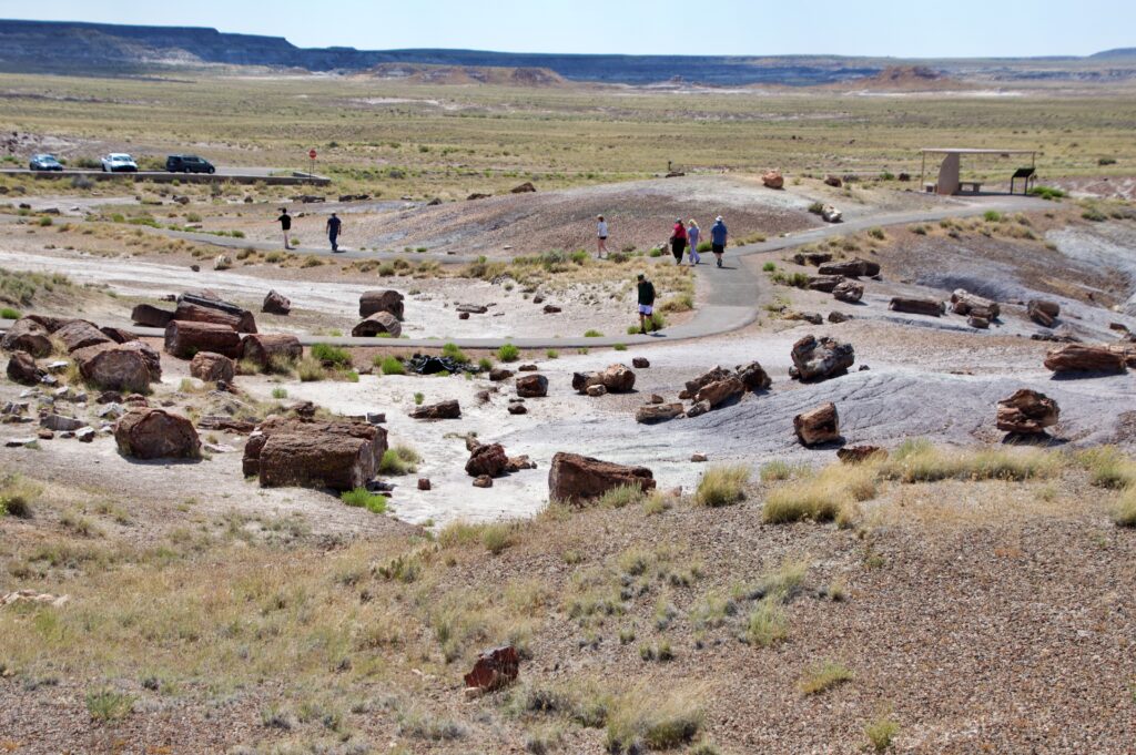
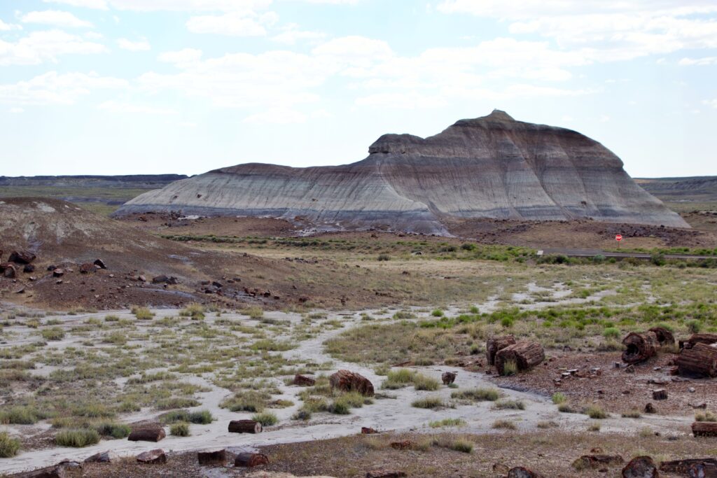
The Petrified Forest National Park offers one of the most distinctive landscapes along Route 66, where the desert is scattered with ancient, fossilized wood that has transformed into stone over millions of years. Weathered logs, now preserved in vivid mineral colors, lie across the terrain like remnants of another time.
Beyond the prehistoric landscape, petroglyphs etched into rock surfaces and the remains of ancient dwellings point to the presence of early civilizations that once lived in and moved through this region.
As Route 66 passes through the park, the experience shifts from the rhythm of the road to something more still—where layers of natural and human history overlap, stretching far beyond the highway.
Wigwam Motel — Holbrook
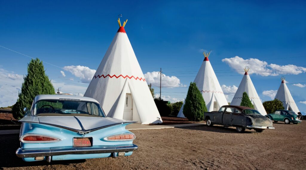
The Wigwam Motel in Holbrook stands as one of the most recognizable and enduring lodging stops along Route 66, where individual rooms are built in the shape of teepees, creating a distinctly memorable roadside presence.
The Wigwam Motel in Holbrook, Arizona — one of only three surviving Wigwam Village motels left on Route 66. Photo by Carol Highsmith’s America on Unsplash
Originally part of a small chain of themed motels, this location reflects an era when travel was defined by novelty, creativity, and independently owned businesses designed to draw the attention of passing motorists.
Today, the motel remains in operation, offering a preserved glimpse into mid-century roadside culture while continuing to function as a place to stay. Along this stretch of Route 66, it highlights how the experience of the road extended beyond movement—shaping how travelers paused, stayed, and remembered the journey.
Standin’ On The Corner — Winslow
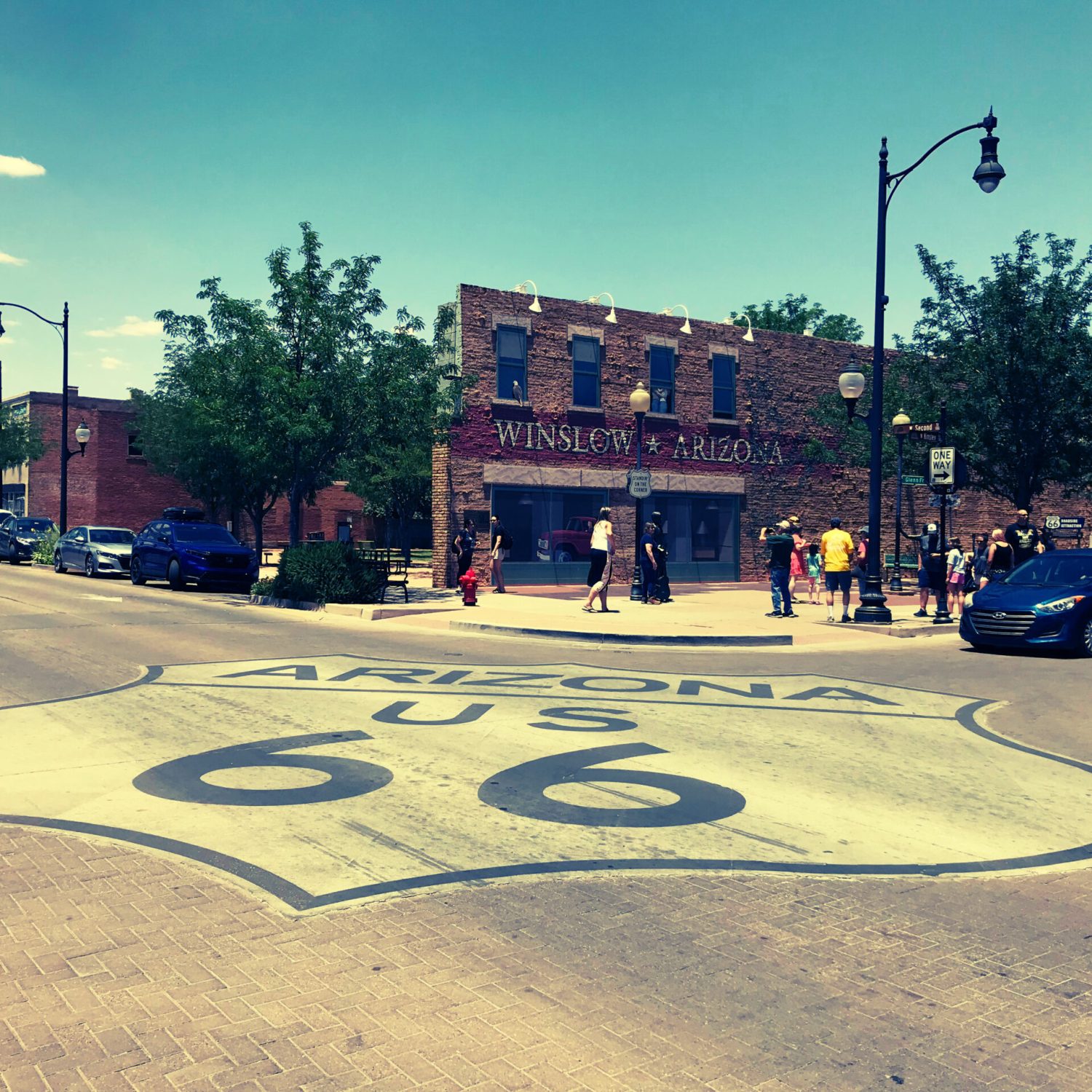
Visitors gather outside the iconic Standin’ on the Corner site in Winslow, Arizona, a tribute to the Eagles’ song “Take It Easy.”
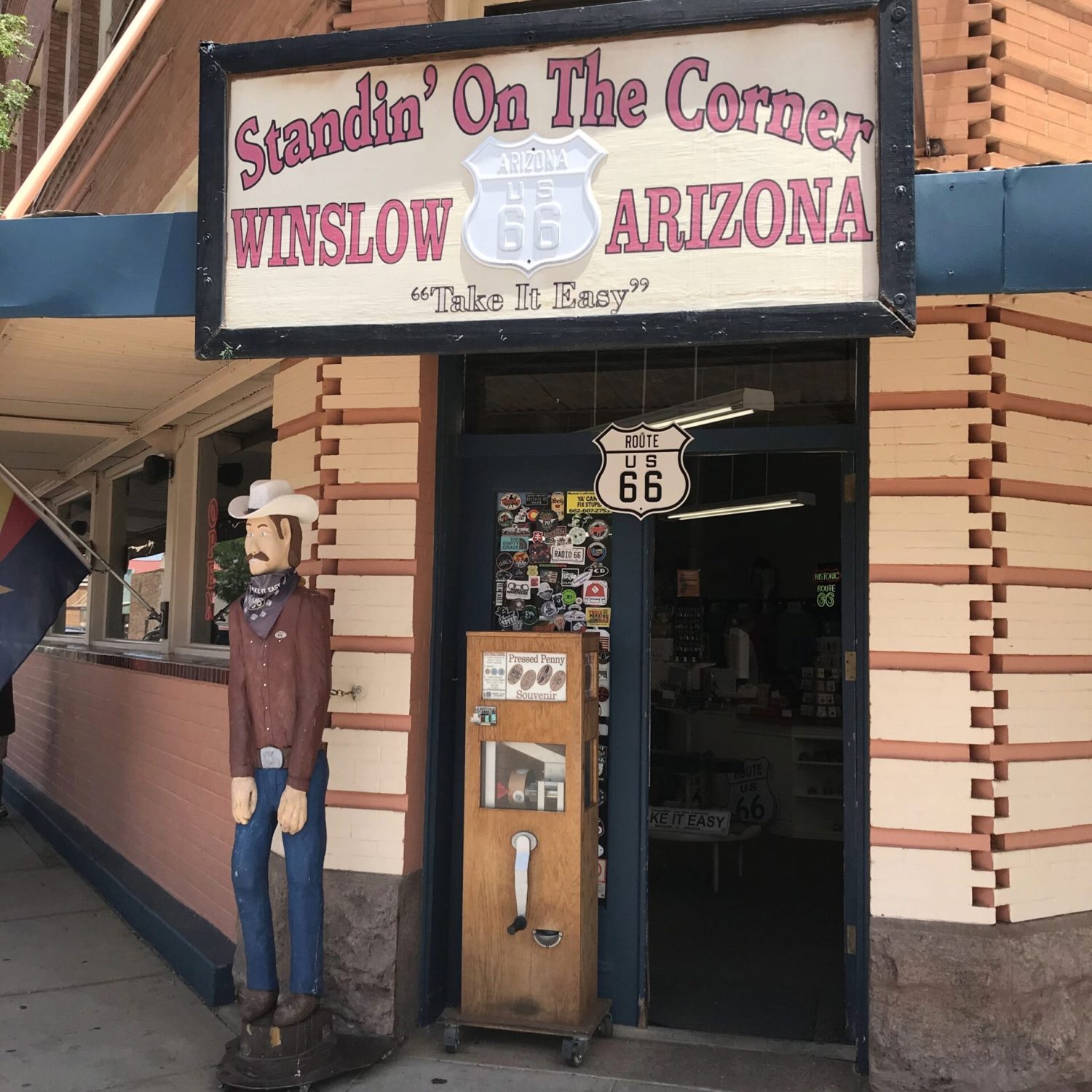
The Standin’ on the Corner storefront in Winslow, Arizona features a classic Route 66 sign, a statue inspired by the song “Take It Easy,” and a small shop filled with nostalgic details.
Standin’ on the Corner in Winslow brings a playful, lighthearted moment to Route 66, inspired by the Eagles’ song “Take It Easy.”
The corner has been transformed into a small tribute, complete with a mural, bronze statue, and a steady soundtrack of music drifting through the air from nearby speakers. A shop filled with memorabilia adds to the experience, making it as much about browsing and lingering as it is about the photo opportunity itself.
Visitors gather here to take photos and step briefly into the song itself, embracing the more whimsical side of Route 66—where music, memory, and nostalgia come together in a way that invites travelers to pause and have a little fun.
Route 66 Through Flagstaff — Flagstaff
Route 66 through Flagstaff introduces a noticeable shift in environment, where the desert gives way to forested terrain and cooler mountain air. Passing through the heart of the city, the road becomes part of a lived-in landscape—lined with historic buildings, local shops, and traces of its past alongside the rhythms of a modern town.
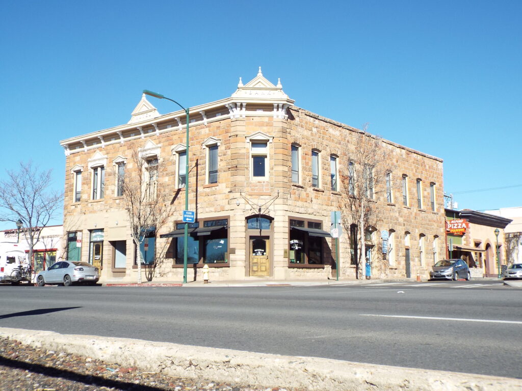
One of those historic buildings is the McMillan building. Construction on this sandstone corner building began in 1886, but the original developers ran out of money before it was finished — an ironic start for what was meant to be a bank. Thomas F. McMillan, Flagstaff’s first non-Native settler, bought the unfinished shell and completed it himself in 1888, turning it into the Arizona Central Bank and Hotel. McMillan has his own claim to fame beyond the building: the town’s very name comes from a flagpole raised near his sheep camp to celebrate the 1876 U.S. centennial.
The Bank Hotel (McMillan Building) on the corner of Leroux Street and Route 66 in Flagstaff since 1888 — now home to The McMillan Bar and Kitchen. Photo: Marine 69-71, CC BY-SA 4.0 https://creativecommons.org/licenses/by-sa/4.0, via Wikimedia Commons
The building quickly became one of Flagstaff’s social centers, with the McMillan Opera House occupying the ground floor and hosting dances, plays, and community gatherings well into the early 1900s. It’s changed hands and purposes many times since — bank, hotel, tailor shop, photo studio, art gallery — but has stayed in McMillan family ownership for generations. Today, it operates as The McMillan Bar and Kitchen, a modern restaurant that leaned into rather than away from the building’s age, restoring the historic corner while keeping it very much a working part of downtown. It still sits exactly where Route 66 meets Leroux Street, one of the oldest buildings left in a city that grew up almost entirely with the railroad, and later the highway, running through it.
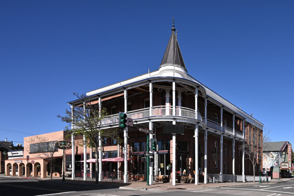
The Weatherford Hotel has anchored downtown Flagstaff since 1900. Photo: G. Edward Johnson, CC BY 4.0 https://creativecommons.org/licenses/by/4.0, via Wikimedia Commons
Just up Leroux Street, the Weatherford Hotel has anchored its own corner since 1900, and it comes with one of Flagstaff’s better small stories. Frequent guest Jimmy Swinnerton, a well-known newspaper cartoonist, checked into the Weatherford around 1915 specifically to dry out from a drinking habit — and, when not spitting off the third-floor balcony at passersby (an actual reported pastime), spent his sober stretches there painting.
A Golf Game with a Movie Star
One of the best-known local stories from Flagstaff’s Route 66 era doesn’t involve a building at all. In 1949, a 13-year-old local boy named Joe Riordan was walking to his summer job at a small golf course when a stranger in a large black car offered him a ride — and then asked him to play a few holes. The boy agreed, they played three holes together, and that was that. That evening, his mother came home from cocktails at the Hotel Monte Vista, where she’d been invited to meet the film star staying there, and asked her son if he knew who he’d golfed with that morning. He had no idea. It was Clark Gable, in town, as he often was, to hunt and fish. Decades later, Riordan admitted he remembered the stranger’s car better than he remembered the man himself.
Seligman Historic District — Seligman
The Seligman Historic District reflects a pivotal moment in the story of Route 66, where preservation and nostalgia helped revive interest in the road after it was bypassed by the interstate.
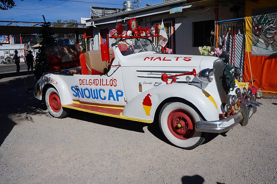
Delgadillo’s Snow Cap Drive-In in Seligman, one of the whimsical roadside stops that helped spark the Route 66 preservation movement Angel Delgadillo started. Photo: Pierre André Leclercq, CC BY-SA 4.0 https://creativecommons.org/licenses/by-sa/4.0, via Wikimedia Commons
That revival has a name: Angel Delgadillo. Born in Seligman in 1927, in a house right along the highway, Angel opened a barbershop here in 1950, in the same building his father had run a barbershop and pool hall since 1922. For decades, Route 66 carried about 9,000 cars a day through town — until September 22, 1978, at 2:30 in the afternoon, when Interstate 40 opened and all of that traffic vanished overnight. “The town died for ten years,” Delgadillo later said. “We were forgotten by the world.”
Rather than accept that, Angel and his wife Vilma organized local business owners and founded the Historic Route 66 Association of Arizona in 1987 — the first group of its kind. Their campaign succeeded: in 1988, 159 miles of the old highway through Arizona were officially dedicated as “Historic Route 66,” and the model spread, with similar associations eventually forming in every Route 66 state. Seligman became known as the Birthplace of Historic Route 66, and Angel himself earned nicknames like “The Guardian Angel of Route 66” and “The Father of the Mother Road.” His barbershop-turned-gift-shop still stands downtown; when Pixar’s John Lasseter came through town researching Route 66 for Cars, he met Angel and used his story of Seligman’s near-disappearance as the emotional backbone of the film’s Radiator Springs.
Lined with vintage signage, colorful storefronts, and classic roadside details, the area captures the spirit of mid-century travel while maintaining an active connection to the present.
Often credited as the birthplace of the Route 66 revival movement, Seligman feels both intentional and authentic—where the past is not simply remembered, but actively preserved and shared. Along this stretch, Route 66 becomes less about passing through and more about honoring the identity that made the road iconic.
Hackberry General Store — Hackberry
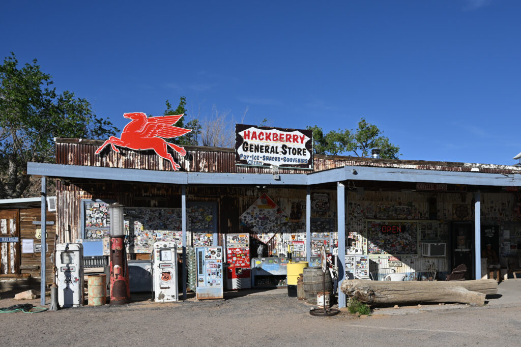
Set against a wide, open desert backdrop, the Hackberry General Store captures the visual essence of Route 66—weathered wood, vintage signage, and expansive space. It feels more like a moment along the road than a destination.
Hackberry started as a silver mining camp in 1874, boomed briefly, then went bust when the mine closed in 1919. It nearly became a true ghost town — until Route 66 gave it a second life. The Northside Grocery and Conoco station opened here in 1934, serving travelers for over four decades, until Interstate 40 bypassed the area entirely in 1978. The store closed and sat empty for 14 years.
Hackberry General Store on Route 66 is one of the most photographed stops. Photo: G. Edward Johnson, CC BY 4.0 https://creativecommons.org/licenses/by/4.0, via Wikimedia Commons
Its revival has a familiar name attached to it. In 1992, artist and mapmaker Bob Waldmire — the same Bob Waldmire whose orange VW Microbus you may have already spotted at the Route 66 Hall of Fame in Pontiac, Illinois, and whose parents invented the corn dog at Springfield’s Cozy Dog Drive-In — bought the abandoned store and reopened it as a Route 66 information post and souvenir shop. True to his preservationist streak, Waldmire deliberately kept the building looking exactly as worn-down and weathered as he found it, rather than fixing it up. Every owner since — John and Kerry Pritchard in 1998, then Amy Franklin in 2016 — has kept that same promise: don’t clean it up, don’t modernize it, just let it keep looking like a ghost town frozen in the middle of a Route 66 heyday.
That philosophy is why it still works. There’s no gas here — the pumps out front have been dry for decades — but there’s a coin-operated payphone that still functions, because Hackberry has no cell service at all. Inside, the collection runs into the thousands: vintage signs, license plates from every state, a working 1962 rotary phone, and even a small case of authentic Elvis and James Dean memorabilia. It’s less a store than a museum that happens to sell root beer.
Oatman — Oatman
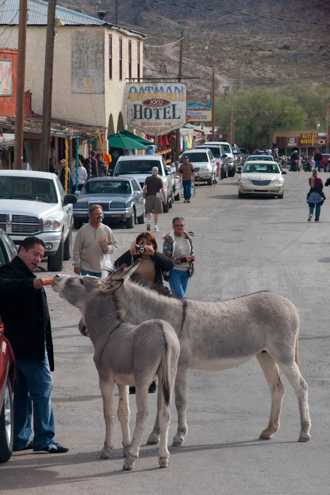
Oatman’s most famous residents don’t pay rent, don’t work, and technically own the town more than anyone else does. Wild burros wander freely down Main Street every day, descendants of pack animals turned loose when the local gold mines shut down. Federally protected and thoroughly unbothered by traffic or tourists, they’ll happily stick their heads through fence rails or into an open car window looking for a handout — it’s part of the reason Oatman calls Route 66 through town “Main Street,” since the burros treat it exactly that way.
Wild burros in Oatman, Arizona, approach visitors for a handout — descendants of pack animals turned loose when the town’s gold mines closed. Photo: Deborah Lee Soltesz, CC0, via Wikimedia Commons
The town’s name carries a heavier story. It honors Olive Oatman, a teenager taken captive after her family was killed on their journey west in 1851. She lived among the Mojave people for several years, and her account of the ordeal later became a bestselling memoir — a story well known enough that a prospector named a gold claim after her decades later. That claim helped spark Oatman’s early boom, and between 1915 and 1917, the town’s mines produced some of the last great gold rushes in the American West, pulling out tens of millions of dollars in ore before wartime restrictions and falling gold prices shut most of it down for good.
What’s left standing today is mostly the Oatman Hotel, built in 1902 and the only building to survive a 1921 fire that leveled much of downtown. It’s no longer a working hotel — but it holds one great piece of Hollywood trivia: Clark Gable and Carole Lombard reportedly spent their wedding night there in 1939, and visitors can still climb the creaky stairs to peek into the room.
Route 66 itself very nearly bypassed Oatman entirely — the section leading into town, nicknamed “the Sidewinder,” packs 191 curves into just 8 miles through the Black Mountains, and it was rerouted around the town in 1953 in favor of an easier path. What kept Oatman alive wasn’t the highway. It was everything the highway left behind.
Today this small desert town preserves the look and feel of an earlier era, with wooden sidewalks and a layout shaped by mining history. Its setting along a winding stretch of road adds a sense of separation from the faster routes nearby.
Roadside Culture & Landmarks
Arizona’s Route 66 culture blends preservation with identity. Roadside stops often appear as they are remembered—motels, diners, and general stores presented in ways that reflect both their original purpose and their place in the story of the road.
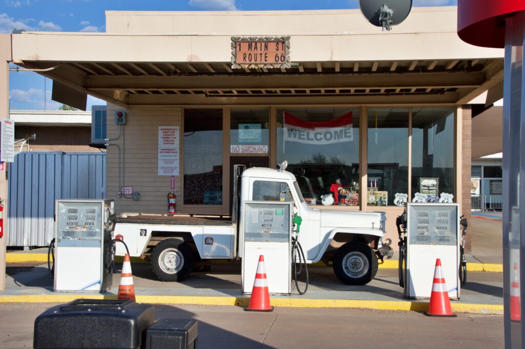
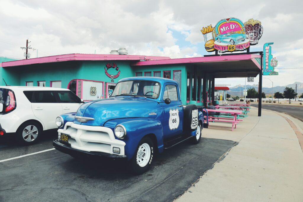
Mr. D’z Route 66 Diner in Kingman, Arizona, with a restored 1954 Chevrolet 3100 pickup parked out front — one of the many roadside stops that keep Route 66’s culture alive. Photo by tommao wang on Unsplash
The visual quality of this stretch plays a strong role in the experience. Landmarks are framed by landscape in ways that reinforce their presence, creating scenes that feel familiar even before they are visited.
Traveling Through Arizona
Traveling Route 66 in Arizona involves a mix of preserved alignments and modern highways, with segments that wind through desert terrain and small towns. Distances between stops vary, and elevation changes—particularly near Flagstaff—introduce shifts in climate and scenery.
The journey through Arizona benefits from pacing that allows the landscape to shape the experience. Light, weather, and time of day all contribute to how the road is perceived and remembered.